The study area is a multi-jurisdictional, requiring extensive coordination to address the complex relationship between land use and transportation. Furthermore, the land use in the study area is very diverse. It includes residential, industrial, commercial, rural, federal lands, tribal land, commercial airport uses, and military instillations to name a few.
A Land Use Distribution Analysis (PDF 92 KB) was conducted to compare the Spokane Regional Transportation Council’s (SRTC) existing land use versus projected land use.
Current Land Use Development Projects
The West Plains area was found to be one of the fastest growing areas in Washington State as defined in a final Research Report “Land Development Risks Along State Transportation Corridors”. The research was led by the University of Washington in a collaborative joint effort with WSDOT and the Spokane Regional Transportation Council (SRTC). The research findings – primarily based on available land, utilities, and infrastructure – predicted steady rapid land use development in the West Plains by the forecast year of 2040.
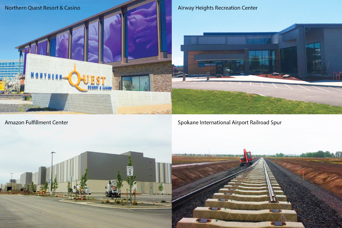
In the past few years, increasing local and tribal government land use planning and implementation of significant developments in the West Plains area confirmed the predicted steady rapid land use development was becoming a reality. The interactive map tool below contains information about recent and ongoing land use development projects since 2015 in the study area, along with local zoning, all of which can be turned on/off.
A full-screen version of the above development map is also available
Additionally, the map image below documents development activities on and adjacent to Spokane International Airport as of January 2022. Select the map to download a PDF copy of the map (3.4 MB).
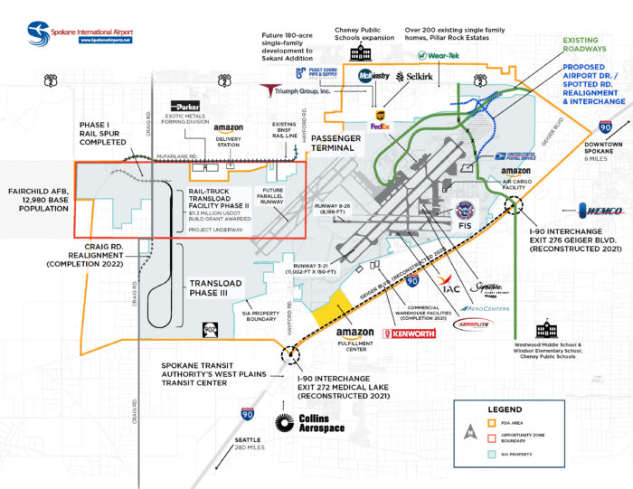
Source: Spokane International Airport
Market Land Use Assessment
Traditionally, land use projections developed by SRTC as part of their travel demand model would be used to forecast future traffic conditions. However, with the West Plains area being one of the fastest growing in the state, a new methodology was used to create a more refined and tailored estimate of what could develop by the year 2040.
The Leland Consulting Group was contracted to conduct an independent market-based development forecast – known as a market land use assessment – to better forecast the development potential of vacant and underutilized properties within the study area using an economic analysis of several factors combined with stakeholder interviews. The results of the assessment were used to better refine the land use inputs used to model traffic forecasts for the planning horizon year of 2040. Additional information about the process used, findings, and how the assessment was used in the travel demand modeling for this project are available in the Land Use and Trip Generation Methodology (PDF 326 KB) document.
The assessment found that there are ample opportunities for continued land use growth in the study area and concluded the following development trends:
- Continued tribal land build out, with major development expected
- Additional Amazon and associated development
- US 2 and I-90 build out, with development clustering around these facilities
- Potential but highly unpredictable development on airport-owned land
- Hotel growth
- Limited office (innovation park)
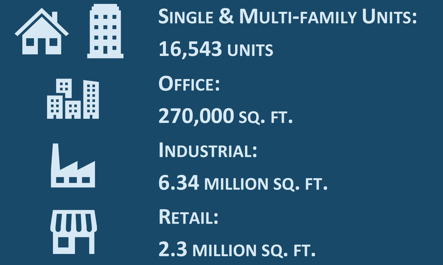
The figure below shows the new development demand estimated by the assessment through 2040, which represents an unprecedented rate of development for the area, especially for housing and industrial uses and Fairchild Air Force Base.
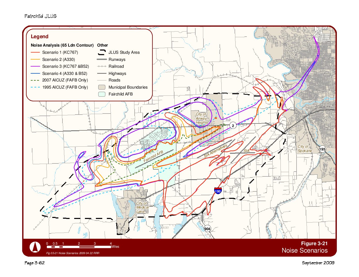
Fairchild Air Force Base – Join Land-Use Study
The Fairchild Joint Land Use Study (PDF 11.1 MB) was conducted by Spokane County to create a community-based plan that builds consensus and obtains support from varied interests, including residents, property owners, local elected officials, business interests, the military, Native American Tribal governments and State and Federal agency representatives. The map below represents the study’s final noise contour map that assess potential noise related to four future mission scenarios.