The West Plains Subarea Transportation Management Plan, Phase 1, US 2 Vicinity study builds upon numerous past studies to develop multimodal practical solutions for mitigating consistently increasing land use growth in the West Plains in the vicinity of US 2. The study purpose, process, and outcomes are summarized in the West Plains Subarea Transportation Management Plan, Phase 1, US 2 Vicinity Executive Summary Document (PDF 26MB). The following presents the study’s final outcomes in the form of multimodal strategies and traffic circulation plan.
Multimodal Strategies
The resulting list of multimodal practical solutions strategies were collaboratively developed during a Practical Solutions Lab / Workshop. These strategies aim to provide practical solutions to address existing and future congestion and improve quality of life, and are presented in the following sections of this page and available as a downloadable list at the link below:
Categorized List of Multimodal Practical Solutions Strategies Prioritized by Percentage of Effectiveness (PDF 184KB)
As described on the Practical Solution Workshop / Lab page, the developed strategies are grouped into seven categories. Selecting a category in the following list will take you to its definition and list of strategies, which includes agencies and/or jurisdictions that have the lead responsibility in implementing each strategy. Strategies are listed in the order of their calculated percent of effectiveness, as evaluated by the project’s Technical Advisory Team (TAT).
- Safety
- Freight
- Environmental
- Equity
- Active Transportation
- Public Transportation
- Transportation Management Systems Operations (TSMO)
- Traffic Operations
- Land Use
Safety
Strategies aimed at reducing fatal and serious injury crashes for all modes.
| Percent of Effectiveness Rank | Practical Solution Strategy | Strategy Efforts Led or Provided By |
|---|---|---|
| 1 | Add accessible multi-modal facilities with scale lighting | For shared use paths within City limits: City of Airway Heights/City of Spokane. Areas associated along US 2: WSDOT/City of Airway Heights/City of Spokane. Areas outside city boundaries: Spokane County/WSDOT and Others |
| 2 | Deploy roundabout training and instructional materials to employees and residents within the study area along with driver information (e.g. VMS sign) | WSDOT/Department of Licensing/Driver Education Schools |
| 3 | In regards to development, adhere to access management strategies that encourage right in-right out turn restrictions, use of channelization strategies and delineated access points | WSDOT/City of Airway Heights/City of Spokane/SRTC |
| 4 | Partner with major traffic generators in providing driver education to address risky behavior | STA/S3R3 PDA/City of Airway Heights/City of Spokane/Spokane County/SRHD/Department of Licensing/Driver Education Schools |
Safety | Freight | Environmental | Equity | Active Transportation | Public Transportation
Transportation Management Systems Operations (TSMO) | Traffic Operations | Land Use
Back to Top

Freight
Strategies to facilitate the movement of goods through the study area.
| Percent of Effectiveness Rank | Practical Solution Strategy | Strategy Efforts Led or Provided By |
|---|---|---|
| 1 | Develop the 18th/21st Ave corridor in a manner that attracts increased freight mobility *** Amended after the Technical Advisory Team Meeting 7/21/21, based on member collaborated comments. | City of Airway Height/City of Spokane/Spokane County/S3R3 PDA |
| 2 | Ensure intersection control measures along US 2 and 18th/21st are designed to provide for freight mobility | City of Airway Heights/City of Spokane/S3R3 PDA |
| 3 | Provide a roundabout at Craig Road/Thorpe Road intersection | Spokane County/City of Airway Heights |
Safety | Freight | Environmental | Equity | Active Transportation | Public Transportation
Transportation Management Systems Operations (TSMO) | Traffic Operations | Land Use
Back to Top
Environmental
Strategies aimed to address environmental concerns.
| Percent of Effectiveness Rank | Practical Solution Strategy | Strategy Efforts Led or Provided By |
|---|---|---|
| 1 | “Consider” fencing along US 2 east of Spotted RD to I-90 vicinity to divert wildlife | WSDOT/City of Spokane |
| 2 | Ensure stormwater treatment areas are designed in a manner that does not attract fowl and negatively affect aviation | WSDOT/City of Airway Heights/City of Spokane/Spokane County |
Safety | Freight | Environmental | Equity | Active Transportation | Public Transportation
Transportation Management Systems Operations (TSMO) | Traffic Operations | Land Use
Back to Top
Equity
Strategies to improve the quality of life for all and facilitate inclusive engagement throughout all phases of strategy development, ensuring emerging strategies do not disproportionately impact overburdened communities and vulnerable populations.
| Percent of Effectiveness Rank | Practical Solution Strategy | Strategy Efforts Led or Provided By |
|---|---|---|
| 1 | Pursue broadband opportunities along the corridor to ensure equitable access for disadvantaged populations | City of Airway Heights/City of Spokane/WSDOT/S3R3 PDA |
| 2 | Install electric vehicle charging stations along and/or in the immediate vicinity of US 2 | City of Airway Heights/City of Spokane/S3R3 PDA |
In March of 2022, The City of Airway Heights was awarded a $50,000 Washington State Community Economic Revitalization Board (CERB) planning grant for the City’s Comprehensive Broadband Infrastructure Planning study. This project will study the area’s current broadband infrastructure and future telecommunications needs. CERB funds were matched by $12,500 in local resources.
Safety | Freight | Environmental | Equity | Active Transportation | Public Transportation
Transportation Management Systems Operations (TSMO) | Traffic Operations | Land Use
Back to Top
Active Transportation
Strategies that encourage and support increased active transportation travel by improving access, connectivity, and comfort for bicyclists and pedestrians.
| Percent of Effectiveness Rank | Practical Solution Strategy | Strategy Efforts Led or Provided By |
|---|---|---|
| 1 | Ensure all pedestrian facilities along US 2 are ADA compliant – on US 2 | City of Airway Heights/WSDOT/City of Spokane |
| 2 | Provide lighting on US 2 along multi-use paths/sidewalks/trails in high pedestrian crash areas, as presented in the crash analysis | For shared use paths within City limits: City of Airway Heights/City of Spokane. Areas associated along US 2: WSDOT/City of Airway Heights/City of Spokane. Areas outside city boundaries: Spokane County/WSDOT and Others |
| 3 | Connect missing sidewalks/trails to provide a complete Safe Routes to School path | City of Airway Heights/Cheney School District/Land Developer |
| 4 | City of Airway Heights, Develop and/or update an ADA transition plan for the study area | City of Airway Heights |
| 5 | Pedestrian crossings on US 2 need to be located where significant pedestrian crossings are expected (an engineering study will be required for siting specific crossings outside of intersections) | City of Airway Heights/City of Spokane/Land Developer, with WSDOT concurrence |
| 6 | Evaluate and provide enhanced crossings where needed along US 2 ; from Craig Rd to Hayford Rd | City of Airway Heights/WSDOT/Land Developer |
| 7 | Provide multi-use path down alley of 13th Ave (north of US2 alleyway) between Craig Rd and Russell St to provide for a multi-modal corridor primarily designed for active transportation | City of Airway Heights |
| 8 | Minimize pedestrian crossing distance and/or provide center refuge on US 2 | City of Airway Heights/WSDOT/City of Spokane/Land Developer |
| 9 | Identify opportunities to provide maximized pedestrian crossings for access to destinations in the vicinity of US 2 | City of Airway Heights/WSDOT/City of Spokane/Land Developer |
| 10 | Repurpose the public owned right-of-way (behind back of sidewalk) to provide for active transportation facilities and designated parking zones (13th/14th Ave) within the City of Airway Heights | WSDOT/City of Airway Heights/City of Spokane |
| 11 | Prioritize pedestrian movements on US 2 for intersection design and control for signals | WSDOT/City of Airway Heights/City of Spokane |
| 12 | Provide enhanced pedestrian crossings on US 2 (e.g. signs, rapid flashers, HAWK signal, etc.) Engineering study will be required. | City of Airway Heights/WSDOT/City of Spokane/Land Developer |
| 13 | Provide eastbound and westbound bicycle facilities on US 2 within the roadway prism in alignment with the City of Airway Heights Downtown Plan – [ Provide roadway bike path on both sides of US from Craig Rd to Russell St – Provide Provide separated multi-use paths on both sides of US 2 from Mitchell St to Sunset Frontage Road] | City of Airway Heights/City of Spokane/Spokane County; with WSDOT concurrence |
| 14 | Reduce future lane widths to provide a maximum of 11 feet, in coordination with other complete street strategies along US 2 | WSDOT/City of Airway Heights/City of Spokane |
| 15 | Plan and develop a level 1 (crossing for all ages; 8 to 80) grade separated crossing at King St/US 2 (or other identified crossing route) to align with the City of Airway Heights downtown plan and Safe Routes to School | S3R3 PDA/City of Airway Heights/City of Spokane/Spokane County/Cheney School District; with WSDOT concurrence |
Safety | Freight | Environmental | Equity | Active Transportation | Public Transportation
Transportation Management Systems Operations (TSMO) | Traffic Operations | Land Use
Back to Top
Public Transportation
Strategies that encourage and support increased active transportation travel by improving access, connectivity, and comfort for bicyclists and pedestrians.
| Percent of Effectiveness Rank | Practical Solution Strategy | Strategy Efforts Led or Provided By |
|---|---|---|
| 1 | Ensure bus stops are aligned with most frequented activities/destinations | Spokane Transit Authority (STA)/City of Airway Heights/WSDOT/City of Spokane |
| 2 | Support increased transit use by creating more pedestrian friendly environment (safe crossings, first and last mile connections, attractiveness and accessibility) and dense corridor place making | STA/City of Airway Heights/WSDOT/City of Spokane |
| 3 | Pursue High Performance Transit along US 2 | STA/WSDOT |
| 4 | Evaluate the provision of business access and transit lanes (BAT) for transit service | STA/City of Airway Heights/WSDOT/City of Spokane |
| 5 | Optimize fixed-route transit service increasing frequency and shortening travel time | STA with WSDOT concurrence |
| 6 | Develop the US 2, 6th/10th/12th and/or 18th/21st alignments in a manner that supports for long-term bus rapid transit (BRT) | STA/City of Airway Heights/WSDOT/City of Spokane/Spokane County |
| 7 | Pursue Tribal Transit Services to connect into Spokane Area (outside of service hours, currently not served by STA. STA service is: Monday-Saturday: 5:30 am to 11:30 pm / Sundays and Holidays service 8:00 am to 8:00 pm) | STA/Kalispel Tribe/Spokane Tribe/City of Airway Heights/City of Spokane |
| 8 | ITS Plan – Provide communication in real-time for transit signal priority, transit stations and stops | WSDOT/STA/S3R3 PDA/City of Airway Heights/City of Spokane/Spokane County/SIA |
| 9 | Encourage and focus CTR strategy efforts for largest employers | S3R3 PDA/City of Airway Heights/City of Spokane/Spokane County/Spokane Regional Health District (SRHD) |
| 10 | Form a transportation management association to support major employers with enhancing CTR (including employer bus passes) See example: https://www.whatcomsmarttrips.org/ | S3R3 PDA/City of Airway Heights/City of Spokane/Spokane County/SRHD |
| 11 | Partner with Commute Smart NW in development of subarea CTR Program | S3R3 PDA/City of Airway Heights/City of Spokane/Spokane County/SRHD |
| 12 | Encourage employers to use staggered shift start/stop times to manage traffic demand (seize opportunities to implement this policy during developer SEPA reviews, and comprehensive planning efforts) | STA/S3R3 PDA/City of Airway Heights/City of Spokane/Spokane County/SRHD |
| 13 | Add future connection to Route 61 (6th Ave to Craig Rd), and Change Route 63 to travel north on Hayford Rd to 10th Ave then back to US 2 (no detour to airport and Geiger) | STA/S3R3 PDA/City of Airway Heights/City of Spokane/Spokane County/Spokane International Airport (SIA) |
| 14 | Coordinate with Amazon to develop a sustainable plan that will increase their CTR program, encourage travel demand management (TDM), and provide Universal Transit Access Pass Program (UTAP) | STA/S3R3 PDA/City of Airway Heights/City of Spokane/Spokane County/SRHD |
| 15 | Provide first and last mile connection opportunities using scooters and bikes (e.g.. Lime or similar) | STA/S3R3 PDA/City of Airway Heights/City of Spokane/Spokane County/SRHD |
| 16 | Coordinate with employers and others to market and support vanpool/paratransit service | STA/S3R3 PDA/City of Airway Heights/City of Spokane/Spokane County/SIA/SRHD |
| 17 | Provide a 24/7 transit option | STA/S3R3 PDA/City of Airway Heights/City of Spokane/Spokane County/SRHD |
| 18 | Encourage employers to provide showers, bicycle storage at work sites (seize opportunities to implement this policy during developer SEPA reviews, and comprehensive planning efforts) | STA/S3R3 PDA/City of Airway Heights/City of Spokane/Spokane County/SRHD |
Safety | Freight | Environmental | Equity | Active Transportation | Public Transportation
Transportation Management Systems Operations (TSMO) | Traffic Operations | Land Use
Back to Top
Transportation Management Systems Operations (TSMO)
Strategies aimed at more efficiently managing how travelers use the corridor. To learn more about TSMO strategies, please visit WSDOT’s TSMO website.
The following video provides an overview of TSMO:
| Percent of Effectiveness Rank | Practical Solution Strategy | Strategy Efforts Led or Provided By |
|---|---|---|
| 1 | Pursue real-time messaging signs that provide traveler information such as travel times along US 2 versus parallel arterials such as; 6th/10th/12th and 18th/21st (fiber installation required) | City of Airway Heights/City of Spokane/WSDOT |
| 2 | Update the ITS Plan to provide: Real-time communications for traffic monitoring, travel information, volumes, speeds, traffic control monitoring, transit signal priority, communication for transit and Fairchild Air Force Base. Also include cameras at Craig, Lawson and Flint, variable message signs, volume counters, and four miles of fiber trunk (subject to change) | WSDOT |
| 3 | Continue periodic speed management studies on US 2 to determine if the speeds match the current change of built environment of the area (e.g., have land uses and traffic volumes increased such that existing speeds need to be reconsidered) and to identify future speed adjustments to account for the roundabouts | WSDOT/City of Airway Heights/City of Spokane |
| 4 | Explore opportunity to build a micro mobility hub within the study area, by converting existing park-n-ride lots, intermodal hubs or creating a new space (e.g. Eastgate Mobility Hub Visions 2025 (PDF 4.7MB) produced by King County Metro and the City of Bellevue, WA and San Diego Forward‘s mobility hubs) | STA/S3R3 PDA/City of Airway Heights/City of Spokane/Spokane County |
| 5 | Explore new and emerging technologies that can collect safety analytics and identify countermeasures on US 2 | City of Airway Heights/WSDOT/City of Spokane |
| 6 | Apply for the Green transportation capital grant program during the 2023-2025 biennium to fund electric charging stations along or near US 2 | STA/S3R3 PDA/City of Airway Heights/City of Spokane/Spokane County |
| 7 | Continue to support demonstration projects to explore innovative practical strategies including active transportation strategies, such as the “Smart Growth America – Complete Streets Leadership Academy” | WSDOT/STA/S3R3 PDA/City of Airway Heights/City of Spokane/Spokane County/SIA/SRHD |
Safety | Freight | Environmental | Equity | Active Transportation | Public Transportation
Transportation Management Systems Operations (TSMO) | Traffic Operations | Land Use
Back to Top

Traffic Operations
Strategies to improve the flow of traffic, particularly through intersections.
| Percent of Effectiveness Rank | Practical Solution Strategy | Strategy Efforts Led or Provided By |
|---|---|---|
| 1 | Provide and Support Alternative Routes specifically; 6th/10th/12th and 18th/21st planned roads | City of Airway Heights/City of Spokane/Spokane County/WSDOT |
| 2 | Develop the US 2 roadway context in a manner that supports a lower speed limit 35 mph to 30 mph (City of Airway Heights, Lundstrom to Lawson) | WSDOT/City of Airway Heights |
| 3 | Improve Deno Rd (realign/pave) and secure commitment from Fairchild Air Force Base to encourage personnel to use as an alternative route | City of Airway Heights/Fairchild Air Force Base (FAFB) |
| 4 | Advance the West Plains Subarea Transportation Management Plan, Phase 1, US 2 Vicinity, Traffic Circulation Plan | WSDOT/SRTC/City of Airway Heights/City of Spokane/Spokane County |
| 5 | Pursue replacing signal with roundabout (e.g. Flint Road) | WSDOT/City of Spokane |
| 6* | Channelize the US 2 corridor per the West Plains Subarea Transportation Management Plan, Phase 1, US 2 Vicinity Traffic Circulation Plan to restrict outbound left turn movements | WSDOT/City of Airway Heights/City of Spokane/SRTC |
| 7* | Install ramp meter at US 2 / I-90 eastbound on ramp (already in design) | WSDOT |
NOTE: ALL intersection designs will require a traffic study for approval and ALL emerging strategies have to be evaluated for prioritization within respective jurisdictions including WSDOT prioritization to compete for State, Regional and Local Funding.
Safety | Freight | Environmental | Equity | Active Transportation | Public Transportation
Transportation Management Systems Operations (TSMO) | Traffic Operations | Land Use
Back to Top

Land Use
Strategies to promote a more balanced mix of land uses that facilitates shorter trips, use of transit and active transportation, and efficient use of the transportation system.
| Percent of Effectiveness Rank | Practical Solution Strategy | Strategy Efforts Led or Provided By |
|---|---|---|
| 1 | Ensure development projects provide pedestrian connectivity along US 2 | City of Airway Heights/City of Spokane/Spokane County/ with WSDOT Concurrence |
| 2 | Partner with broadband providers for both greater connectivity and ITS and CAT possibilities | WSDOT/City of Airway Heights/City of Spokane |
| 3 | Consider mixed income transit-orientated development within the City of Airway Heights | STA/City of Airway Heights |
| 4 | Provide land use zoning that would generate high land use density along US 2 within Airway Heights downtown | City of Airway Heights |
| 5 | Facilitate proposed “Complete street” improvements within the Airway Heights downtown | WSDOT/City of Airway Heights |
| 6 | Additional growth in population and employment could be planned with an objective of balancing employment growth with development of housing that is affordable and attractive to people earning the wage levels anticipated in the new employment opportunities. | Spokane Regional Transportation Council (SRTC)/City of Airway Heights/City of Spokane/Kalispel Tribe/Spokane Tribe |
| 7 | Support zoning and land use efforts that will enable or promote Transportation Management Systems Operations (TSMO) strategies | City of Airway Heights/S3R 3PDA/City of Spokane/WSDOT |
| 8 | Continue coordination with FAFB to mitigate delay at Mitchell St/US 2 by exploring strategies to address storage off of US 2 | WSDOT/Fairchild Air Force Base (FAFB) |
Safety | Freight | Environmental | Equity | Active Transportation | Public Transportation
Transportation Management Systems Operations (TSMO) | Traffic Operations | Land Use
Back to Top
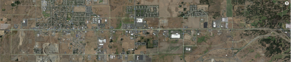
Traffic Circulation Plan
A traffic circulation plan was developed to provide more detail regarding the traffic circulation practical solution strategies. The traffic circulation plan looks at the area in and around US 2 for intersection control along the corridor, including restricting all minor intersections along the corridor from Fairview Heights Road to Sunset Frontage Road to right-in / right-out; however, left turns off of US 2 onto the side streets will be allowed. There is one exception at King Street and US 2 where no left turns from US 2 will be allowed, as this intersection is planned to provide enhanced pedestrian crossings. Ultimately, a level one active transportation crossing is proposed for consideration to accommodate non-motorized travelers ages eight to eighty years old. The plan also includes the 6th/10th/12th and 18th/21st Avenues planned parallel corridors.
A table of intersection strategies is available via the following document:
Traffic Circulation Plan, List of Strategies (PDF 139KB)
A map of the traffic circulation plan is available in high-resolution and reduced file formats via the following links:
Traffic Circulation Plan – high resolution (PDF 38MB)
Traffic Circulation Plan – reduced file size (PDF 6MB)