This online open house ran from January 25 to March 5, 2021. While the public comment window is now closed, WSDOT is keeping the information available for viewing. For construction questions, please contact Chris Hoffman, hoffmac@consultant.wsdot.wa.gov
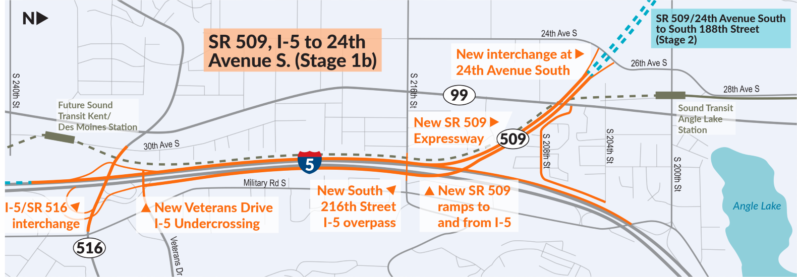
What is included in this project?
Key features of the SR 509, I-5 to 24th Avenue S. – Expressway Project include:
- Reconstructing the I-5/SR 516 interchange
- Building a new roadway, parallel to I-5, that connects SR 509 to Veterans Drive in Kent
- Providing new access via Veterans Drive and a new northbound lane on I-5 between the interchange with SR 516 and the new I-5/SR 509 connection.
- Building a new South 216th Street bridge over I-5
- Building new and extending existing noise walls
- Constructing new ramps that connect I-5 and SR 509 and the first mile of the new SR 509 expressway
- Constructing a new interchange at 24th Avenue South
On December 2, 2020, WSDOT selected Guy F. Atkinson Construction as the design-build contractor for this work. Atkinson will finalize the design in 2021 and then construct the project, including the key features described in this online open house.
Project Timeline
The SR 509, I-5 to 24th Avenue S. – Expressway Project is the first major stage of the SR 509 Completion Project. Construction will begin in 2022 and end in 2025. WSDOT will complete the SR 509 Completion Project with a second stage in 2024 to 2028.
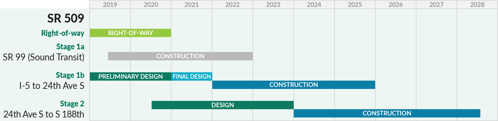
2022 and take about 4 years to complete.