WSF refined the alternatives and screening criteria with the goal of identifying a preferred alternative through Level 3 screening. WSF continues to work with our advisory groups, terminal users, community members and other partners to identify one preferred alternative by:
- Confirming regulatory and permitting requirements.
- Identifying potential environmental impacts and benefits.
- Analyzing future traffic conditions at the terminal and in the surrounding area.
- Developing cost estimates and service level plans during construction to better understand what it takes to build each option and any potential impacts to customers during construction.
- Identifying improvements to make the terminal work more efficiently and make it safer to walk, bike and roll onto the ferry and connect to transit.
- Evaluating operational strategies like intersection improvements to address existing challenges.
- Understanding policy risks and feasibility of building a new terminal.
- Studying the feasibility of implementing Good To Go! or advance ticketing.
- Considering and incorporating input from community and tribal, and agency partners.
Level 3 alternatives
WSF developed concepts that replace the terminal at a similar footprint as the existing terminal (Alternatives A, A-1, A-2 and A-3) and concepts that expand the terminal to provide more on-dock vehicle holding capacity (Alternatives B, B-1, B2, B-3 and C).
Common features of terminal alternatives
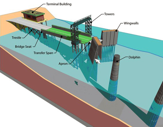
All dock concepts follow WSF’s Terminal Design Manual and include these elements:
- Replacing the dock at the same location as the existing facility.
- Accommodate a total of 186 vehicles (one-and-a-half times the capacity of the Issaquah class ferries that serve the Fauntleroy/Vashon/Southworth route) in a combination of on-dock and Fauntleroy Way SW shoulder holding.
- Meeting current seismic design standards to make sure the new terminal can withstand a major earthquake and raising the dock to accommodate rising sea level.
- Space for a large semitrailer truck to safely navigate through the terminal using designated holding lanes.
- Wider and safer lanes for vehicles and dedicated lanes for people walking, rolling, biking and driving motorcycles onto the ferry.
- Space for terminal operations, including storing materials, mechanical and electrical equipment, trash and recycling containers and parking for terminal supervisors.
- A new terminal building.
- At least two dedicated parking spaces to drop-off and pick-up passengers with disabilities.
- A larger toll plaza with two toll booths, a traffic attendant booth and staff restrooms.
- Minimal dock widening near the shoreline to minimize impacts to Cove Park and environmentally sensitive areas.
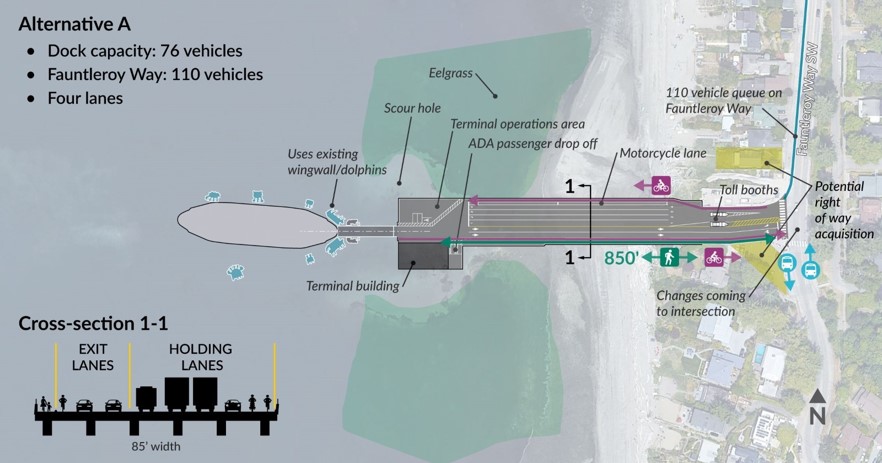
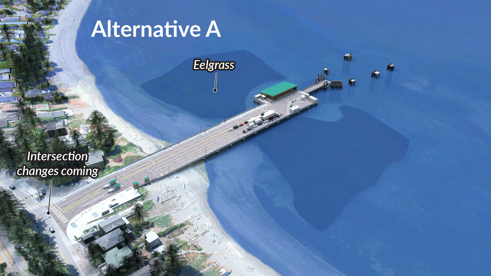
Alternative A – Similar dock size and maintain existing terminal berthing structures
- Alternative A replaces the dock at the same size as the current dock and maintains the existing wingwalls and dolphins, the in-water structures that help guide the ferry into place and protect the dock.
- This alternative holds 76 vehicles, fewer cars than the current dock, with 110 vehicles queuing on Fauntleroy Way SW.
- This concept is slightly wider than the current dock to provide space for a large vehicle to turn onto the dock and provide space for pedestrians, cyclists and vehicles.
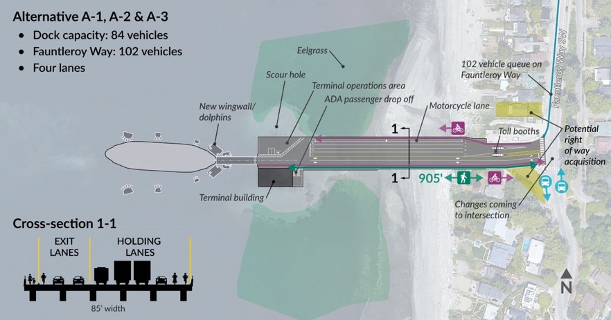
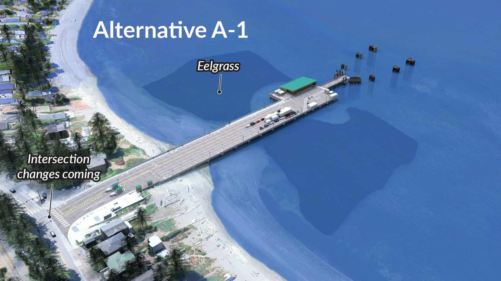
Alternative A-1, A-2 and A-3 – Similar dock size and new terminal berthing structures
- Alternative A-1 is similar to Alternative A but includes new dolphins and wingwalls. This option is slightly longer and holds the same number of vehicles as the current dock, 84 cars, with 102 vehicles queuing on Fauntleroy Way SW.
- Alternatives A-2 and A-3 are variations of Alternative A-1 that have the same layout as Alternative A-1 and include Good To Go! and advance ticketing (A-2), or only advance ticketing technology (A-3).
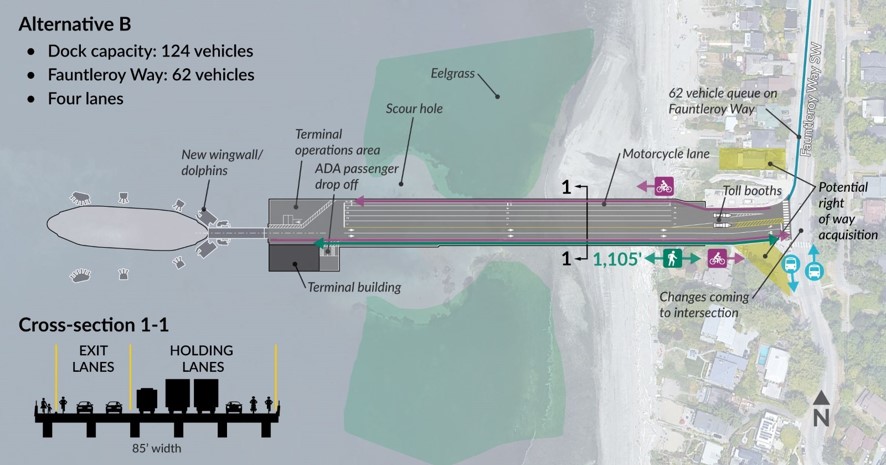
Alternative B – Longer, larger dock
- Alternative B builds a longer and slightly wider dock with more space for large trucks to turn onto the dock. Lengthening the dock moves the ferry slip to deeper water which may allow eelgrass and macroalgae to regrow in and around the scour hole.
- This option holds 124 vehicles, or one full Issaquah Class ferry, with 62 vehicles queuing on Fauntleroy Way SW.
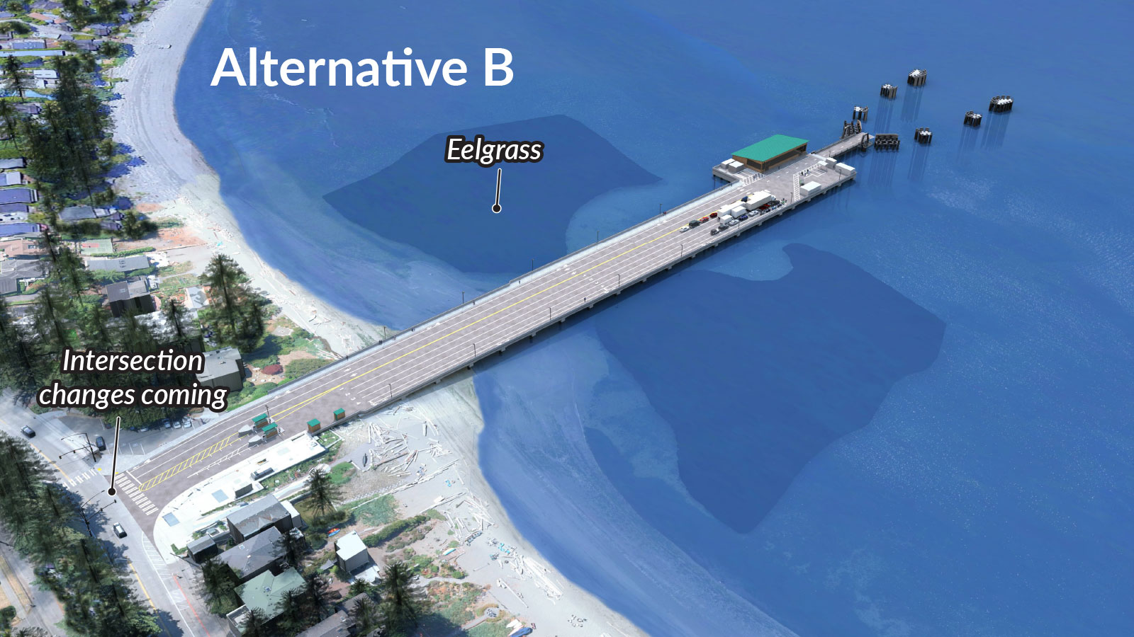
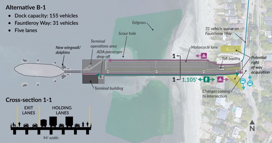
Alternative B-1 – Longer, larger dock with extra holding lane
- Alternative B-1 is the same length as Alternative B and includes one extra holding lane over deeper water north of the dock to minimize impacts to Cove Park and environmentally sensitive areas closer to shore.
- This alternative holds 155 vehicles on the dock with 31 vehicles queuing on Fauntleroy Way SW.

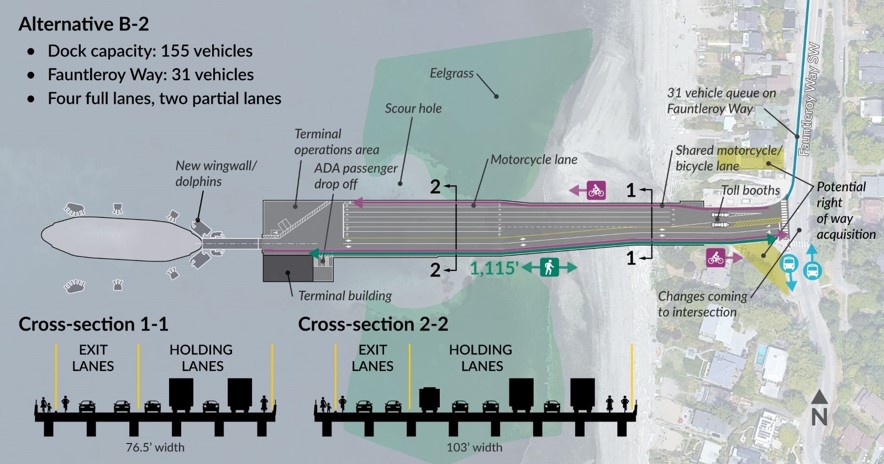
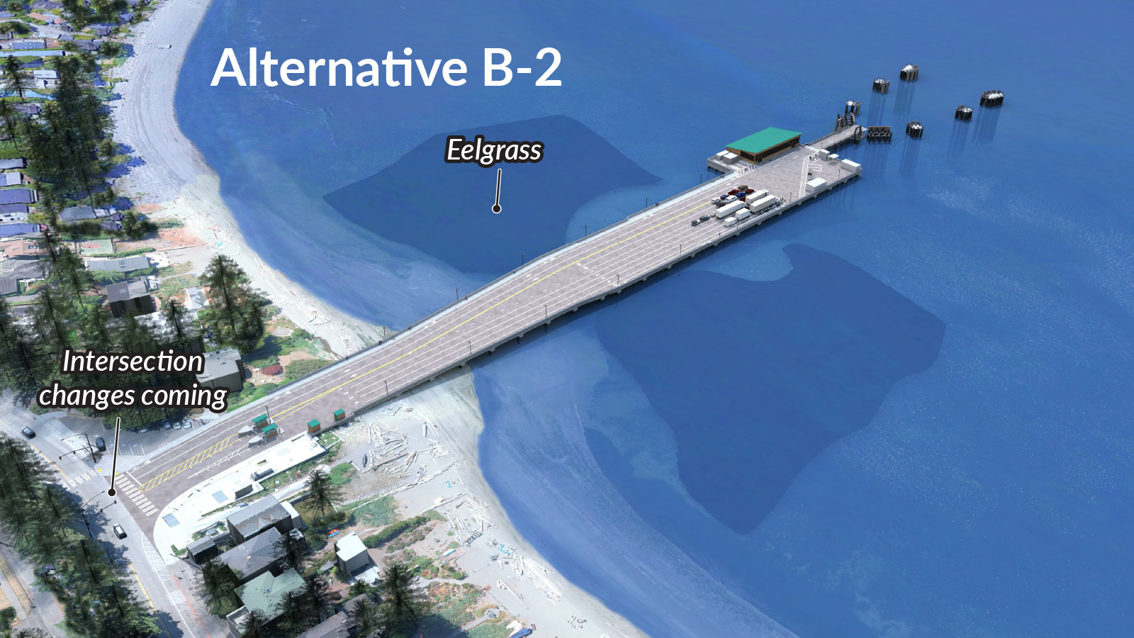
Alternative B-2 – Longer, larger dock with the addition of two shorter holding lanes
- Alternative B-2 adds two shorter holding lanes for priority vehicles, motorcycles and bicycles. This tapered dock design is narrower near the shoreline.
- This dock concept holds 155 vehicles on the dock with 31 vehicles queuing on Fauntleroy Way SW.
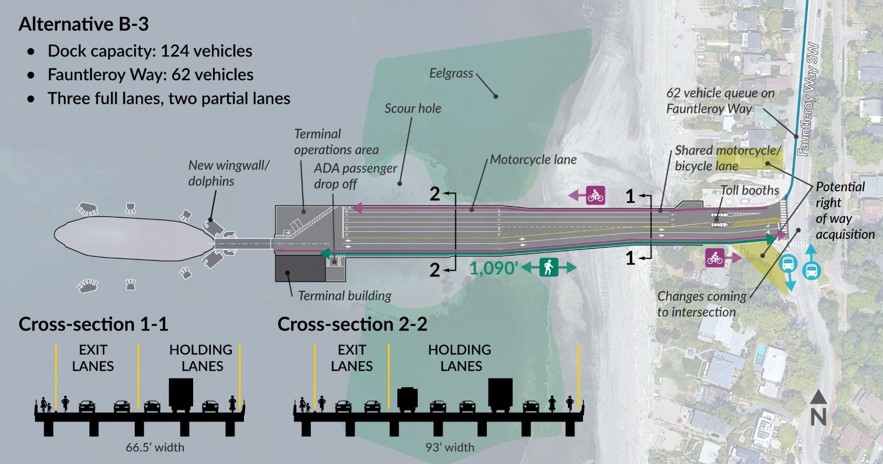
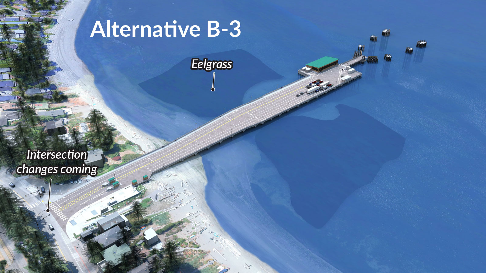
Alternative B-3 – Longer, larger dock with two shorter holding lanes
- Alternative B-3 is slightly shorter than B-2 and includes one less holding lane. The rest of the design features are the same as Alternative B-2.
- This dock option holds 124 vehicles on the dock and has 62 vehicles queuing on Fauntleroy Way SW.
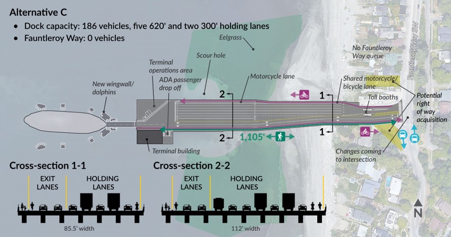
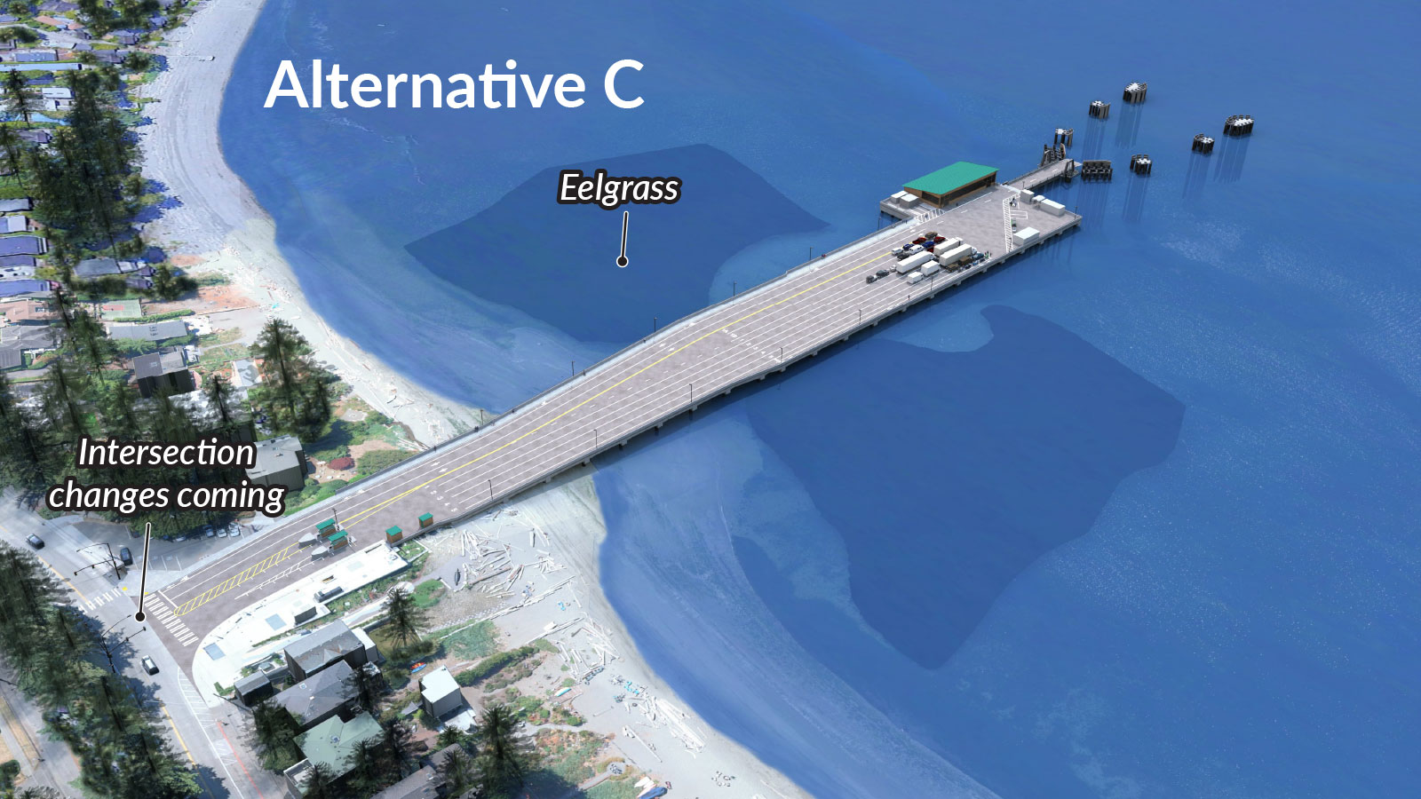
Alternative C – Longer, larger dock with extra full-length holding lane and two shorter holding lanes
- Alternative C adds a full-length holding lane on the north side of the dock. The dock is still narrower near the shoreline and includes two shorter holding lanes for priority vehicles, motorcycles and bicycles.
- This dock option can hold 186 vehicles, removing the vehicle queue on Fauntleroy Way SW on most typical days.
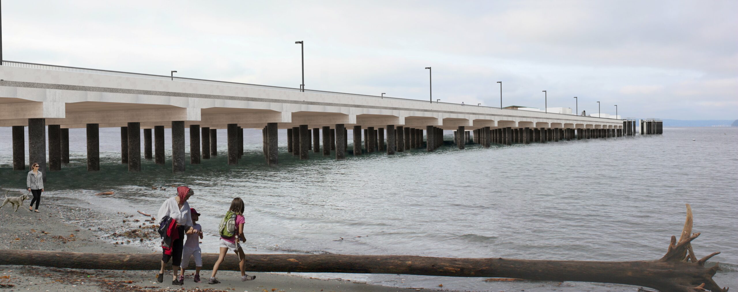
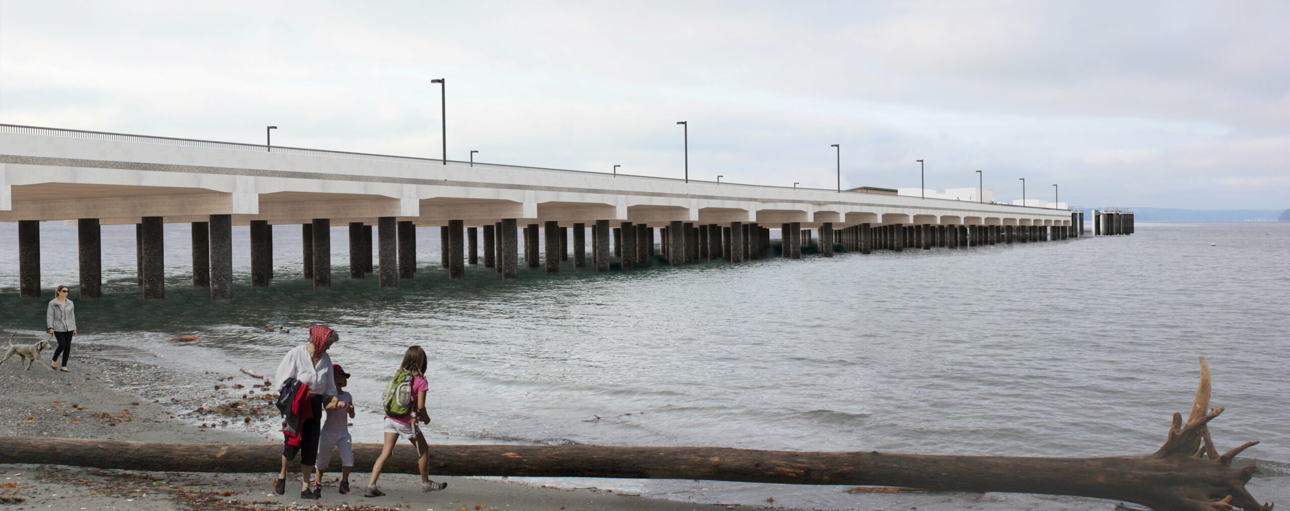
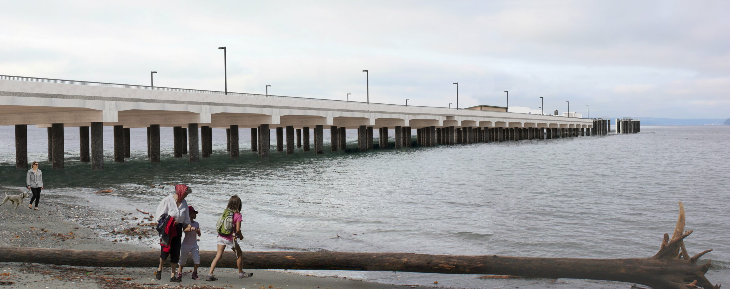
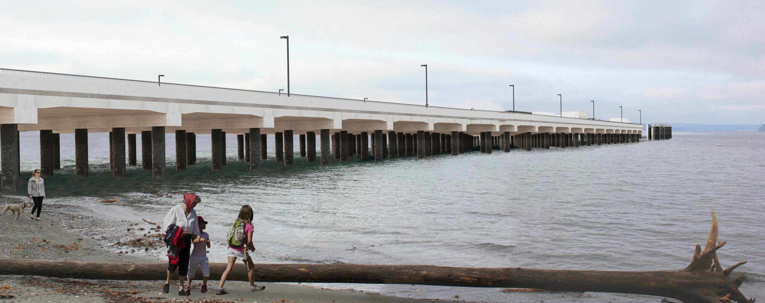
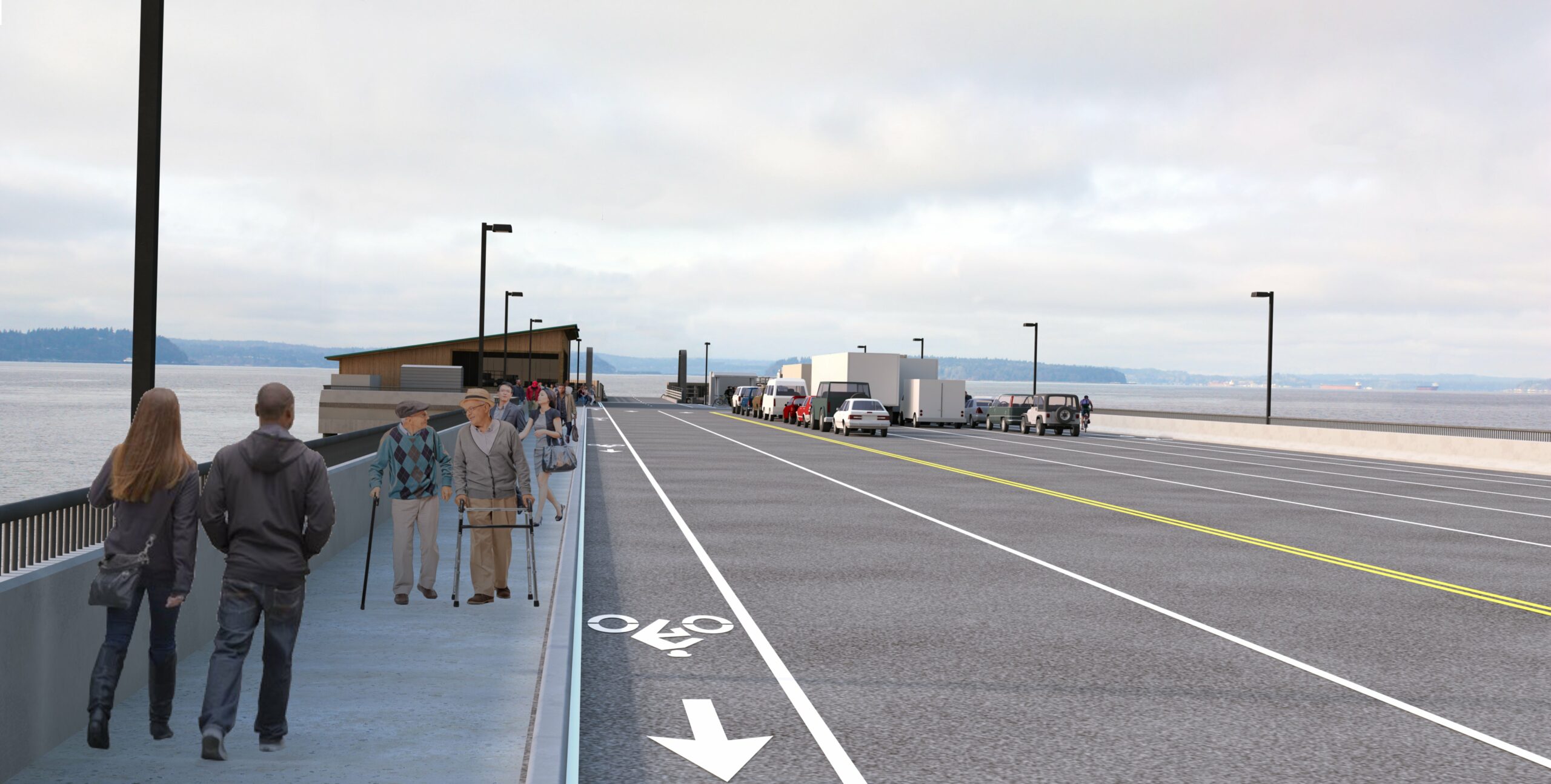
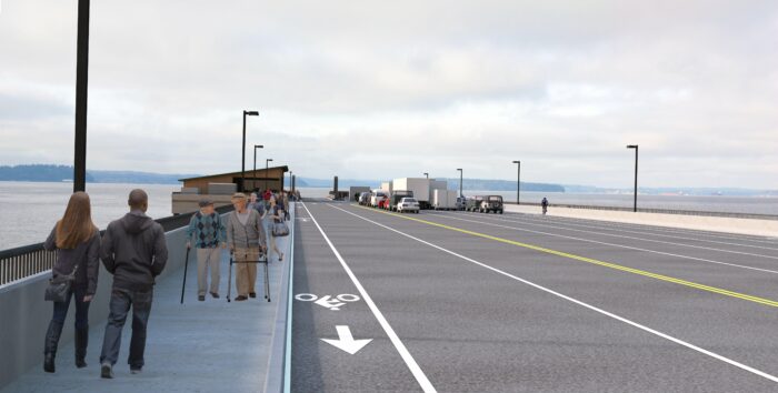
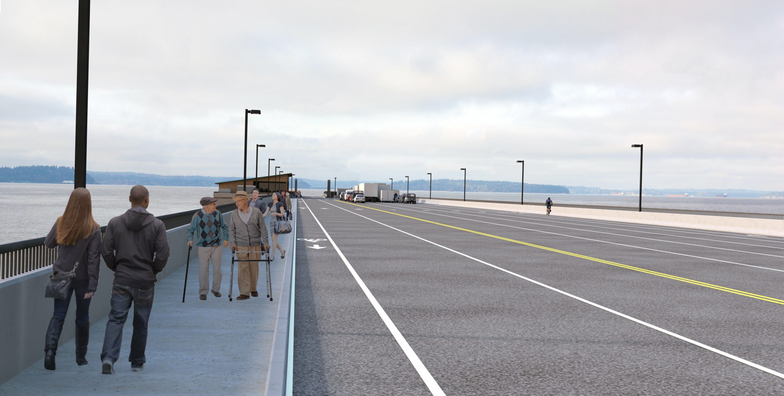
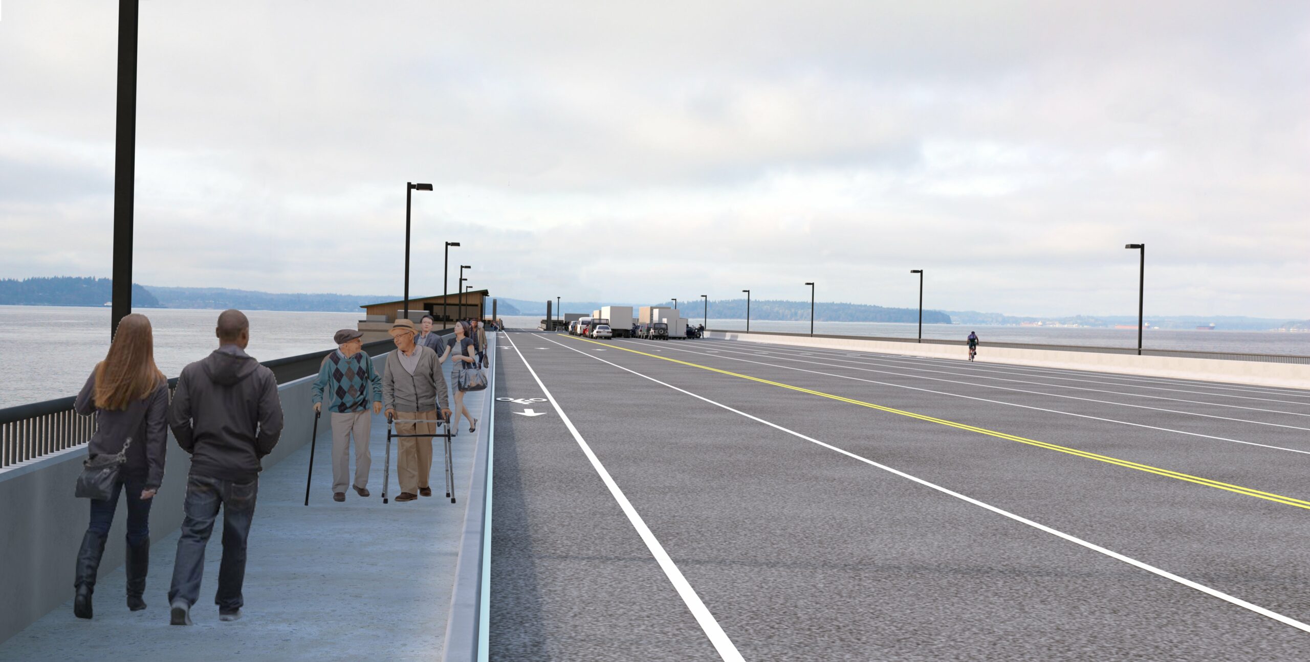
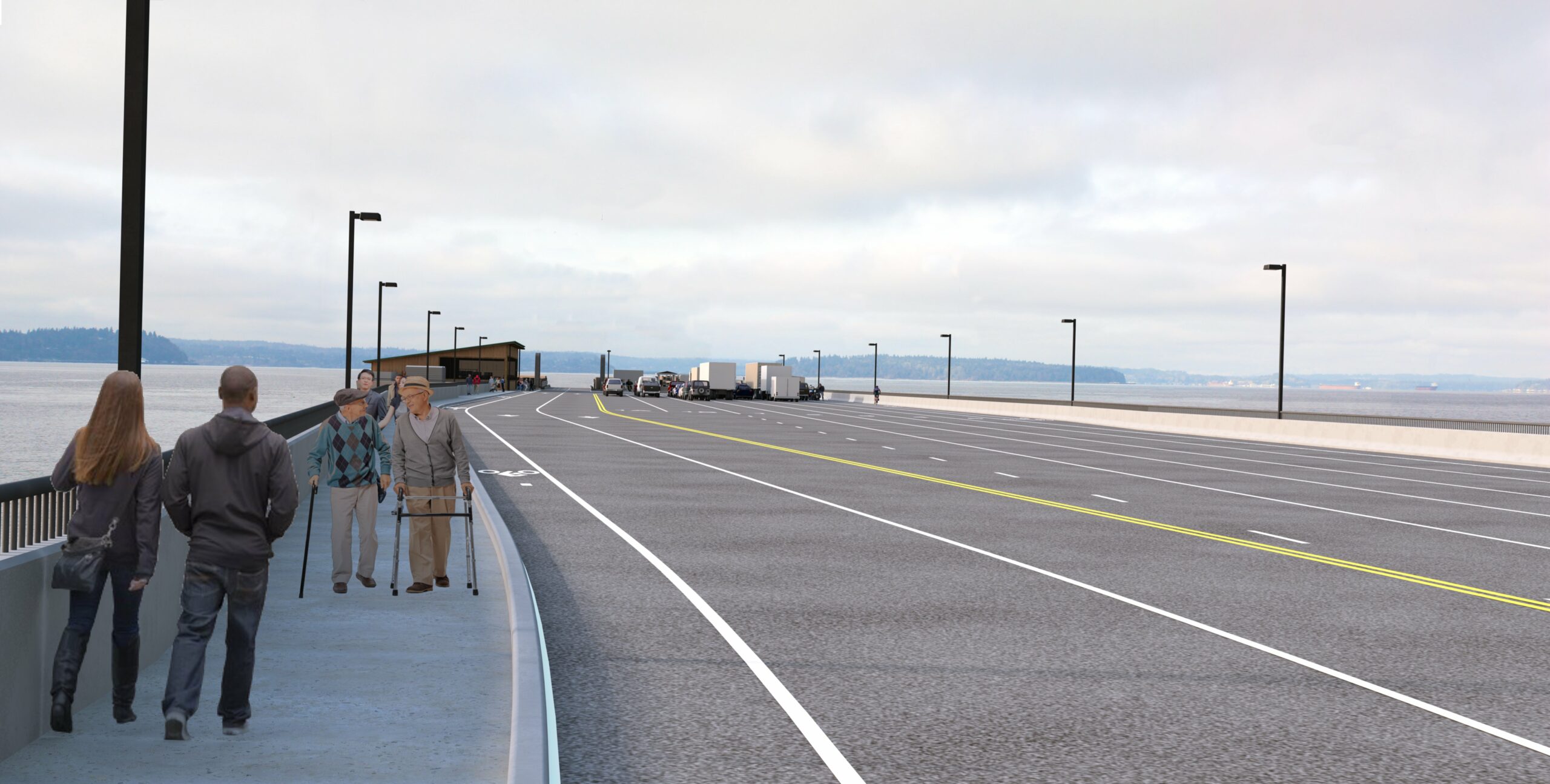
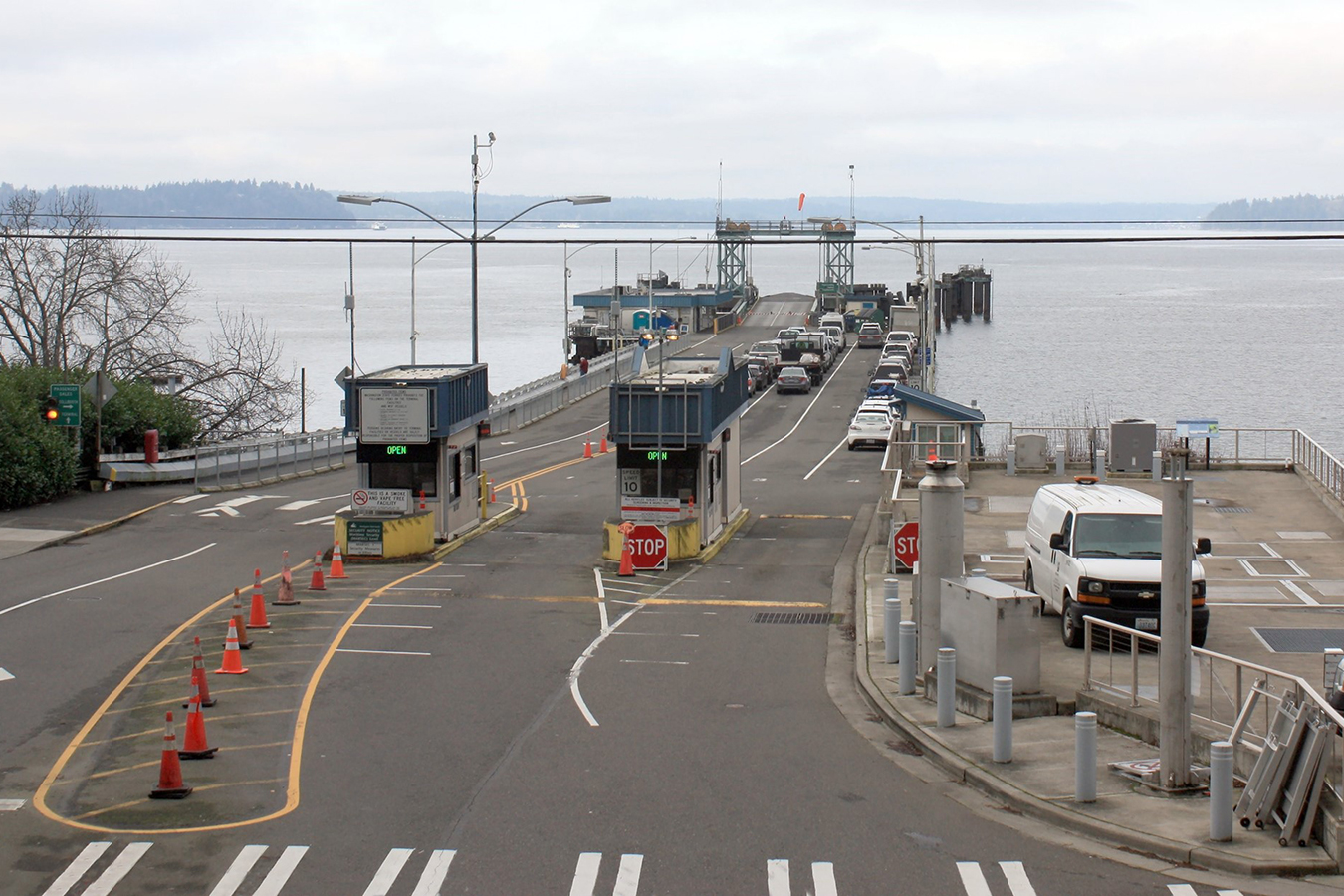
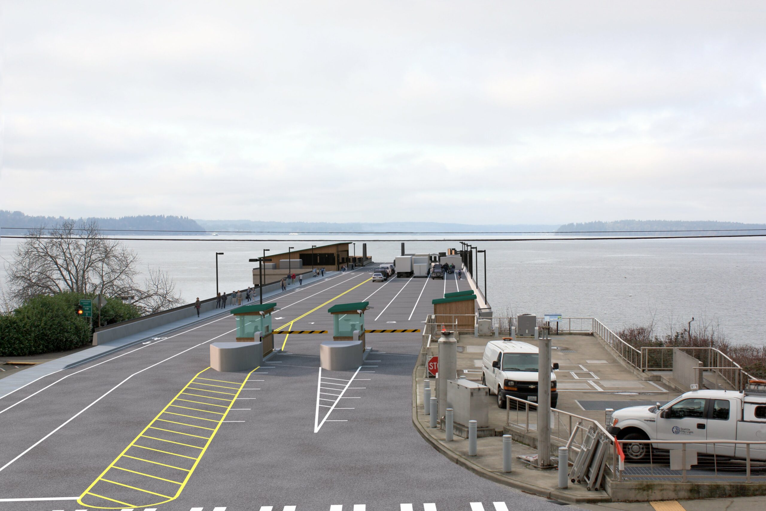
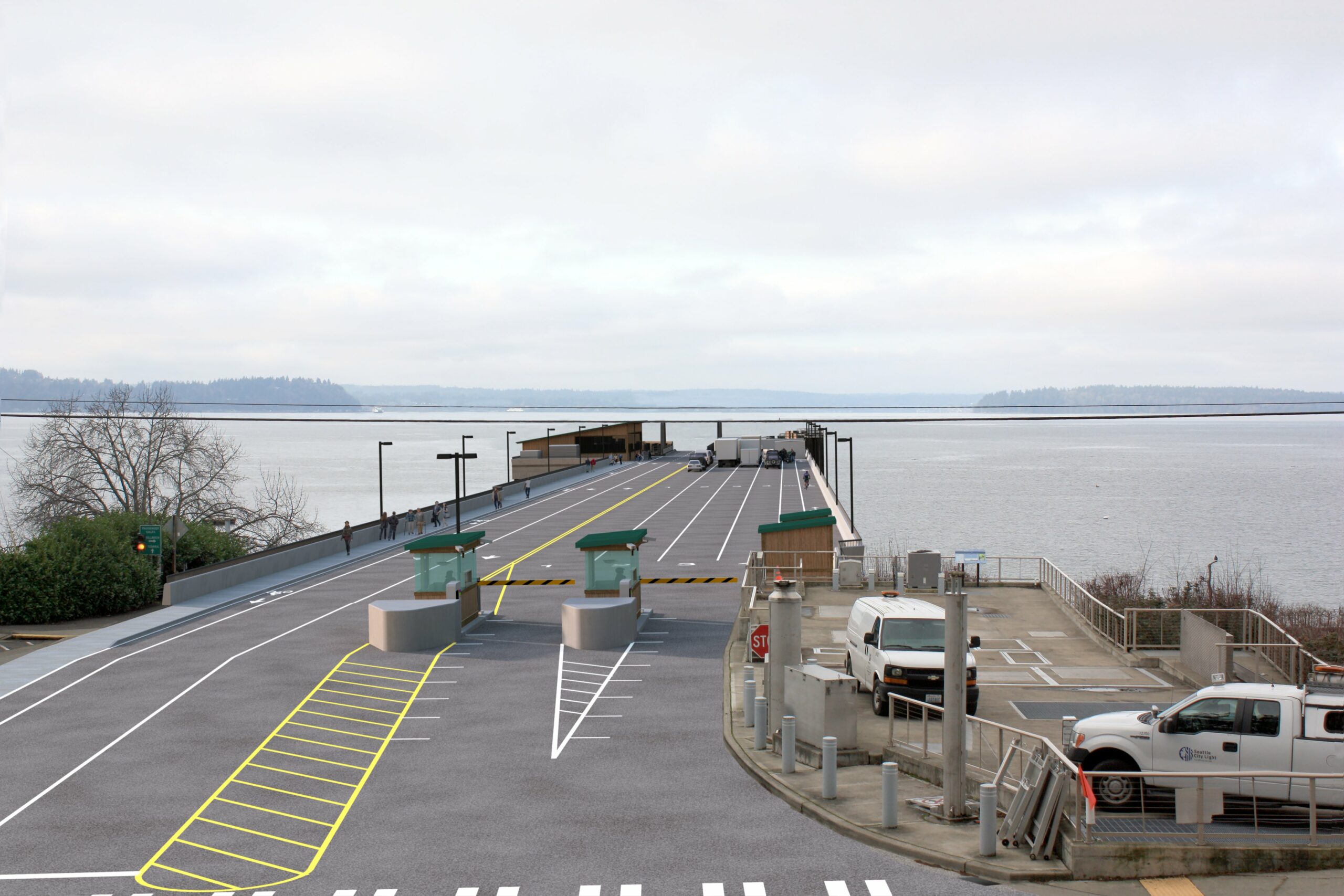
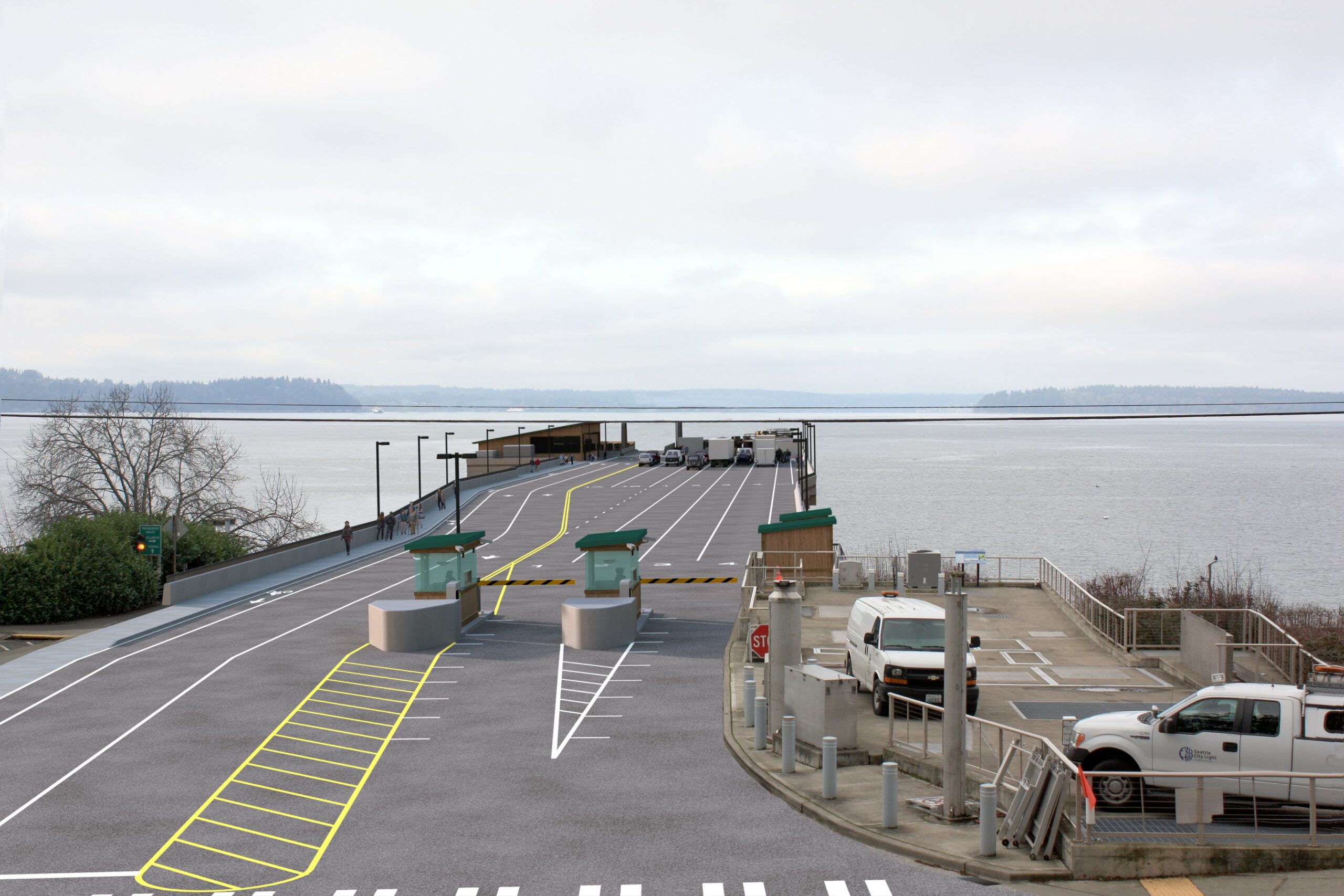
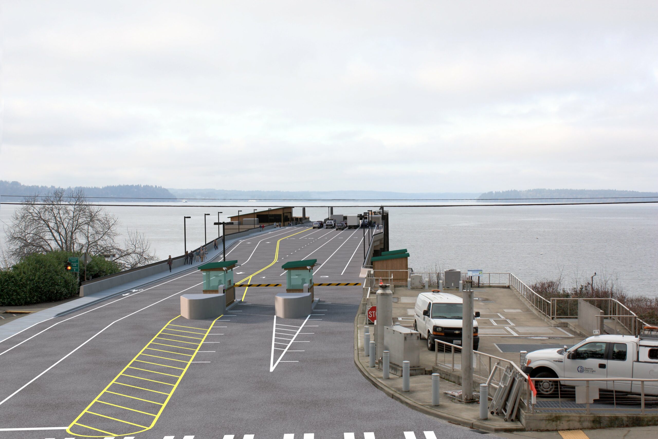
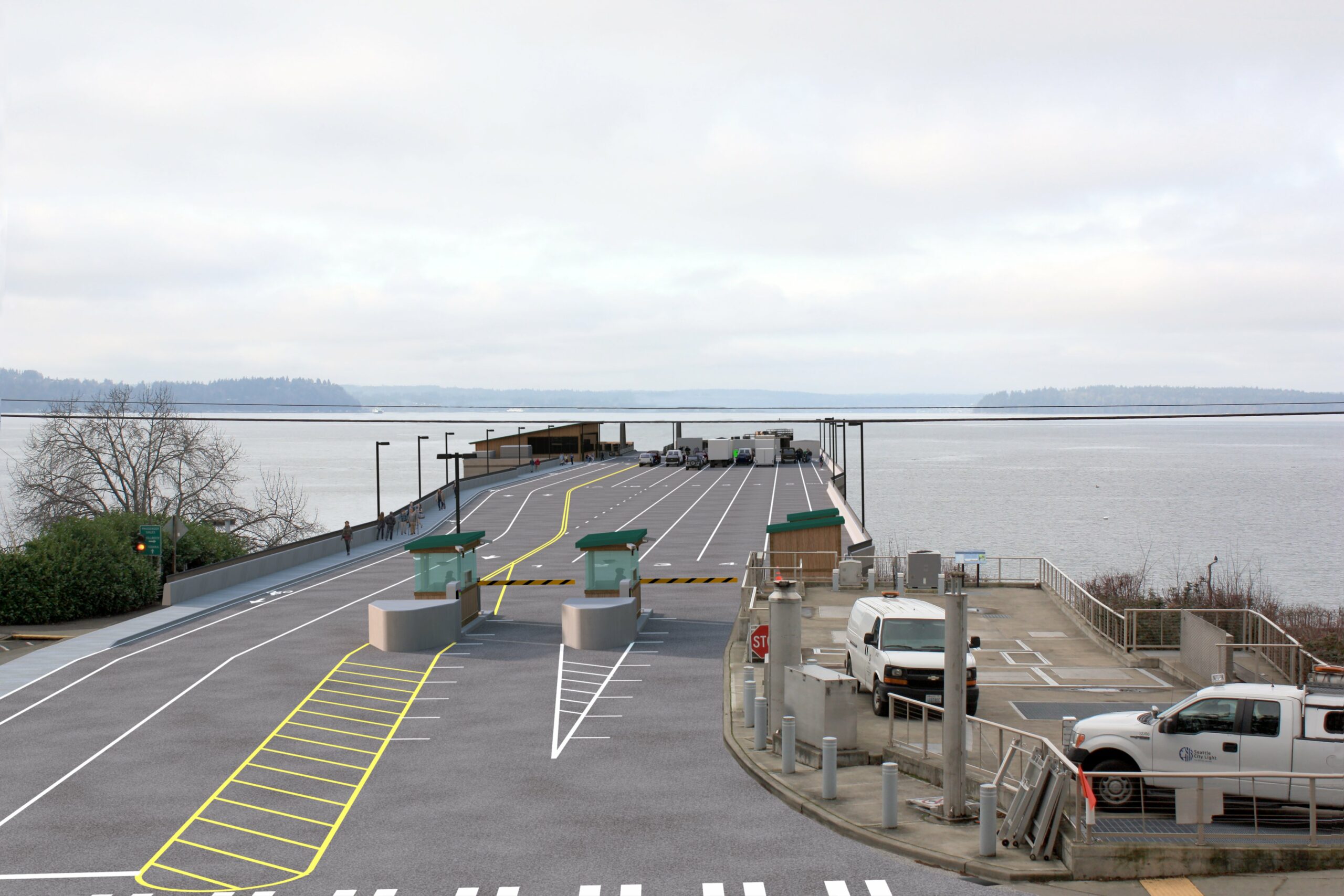
Conceptual design renderings
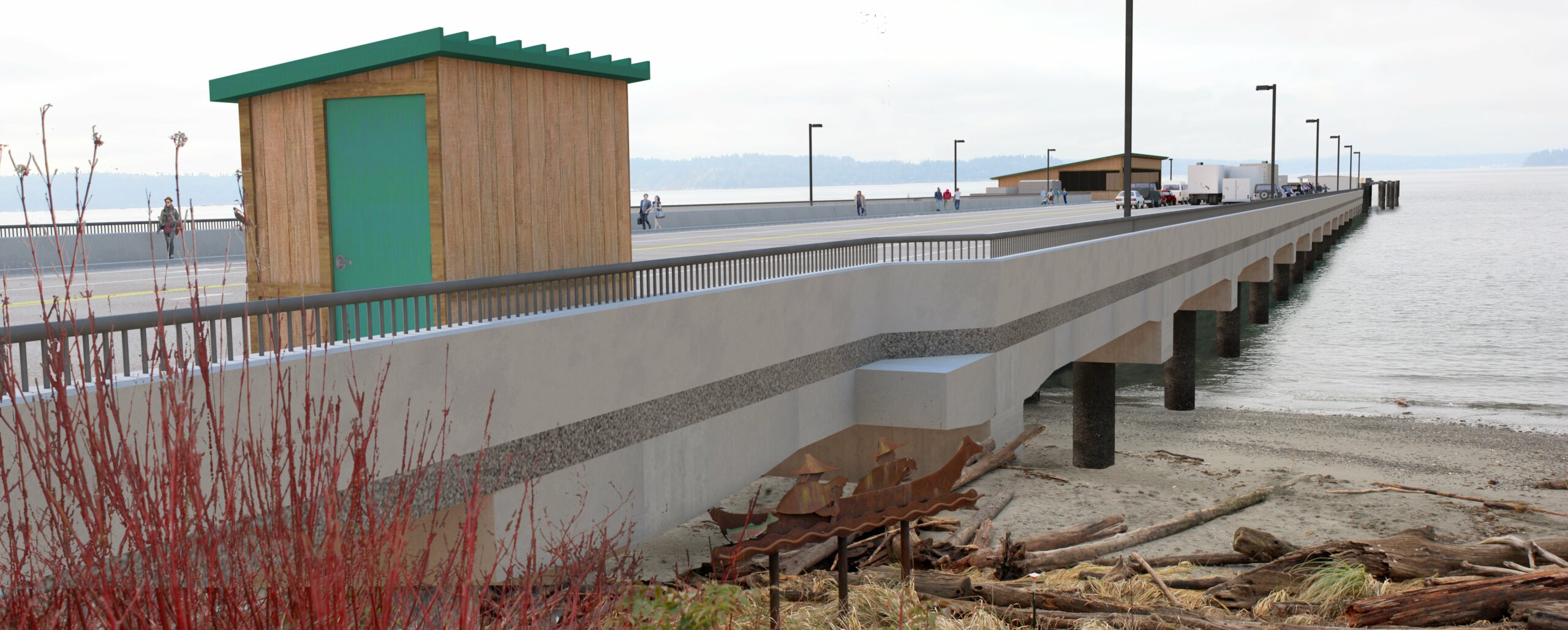
WSF developed design renderings to make it easier to visualize the differences between each alternative. These renderings show conceptual finishes and do not represent any proposed design elements. The intent is to show the general footprint and layout for each alternative. We will seek community input on the design and look and feel of the terminal in future phases of the project.
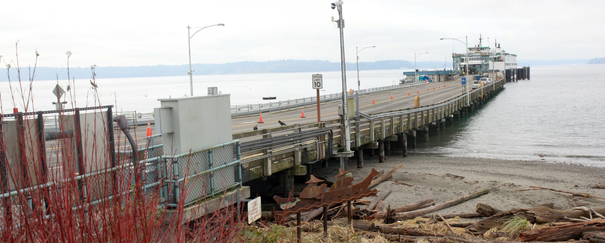
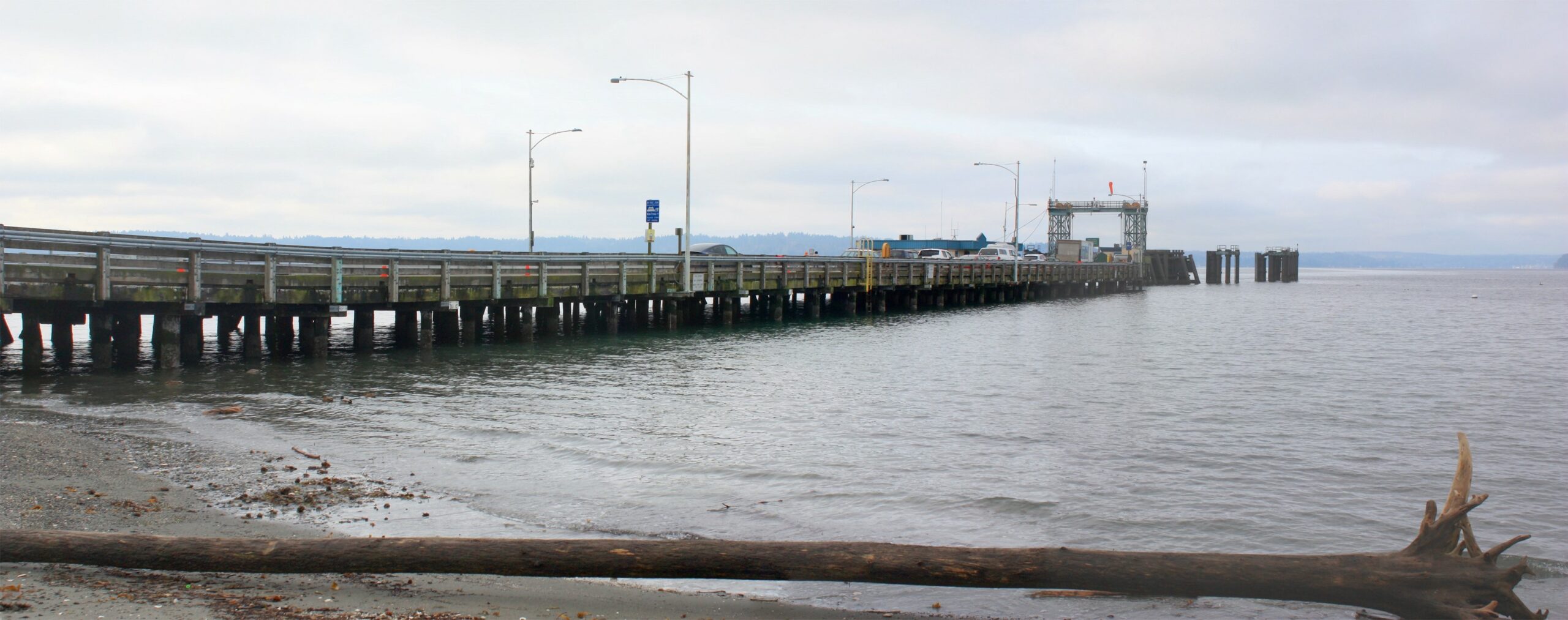
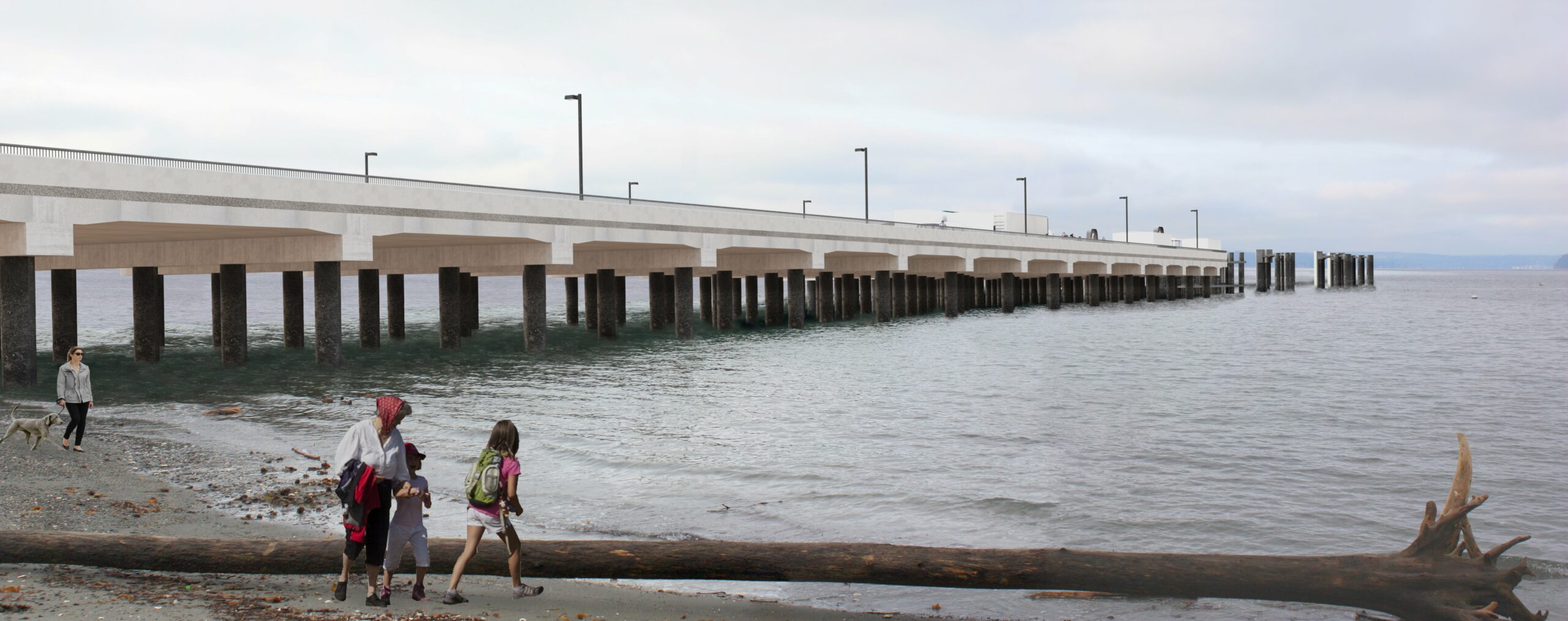
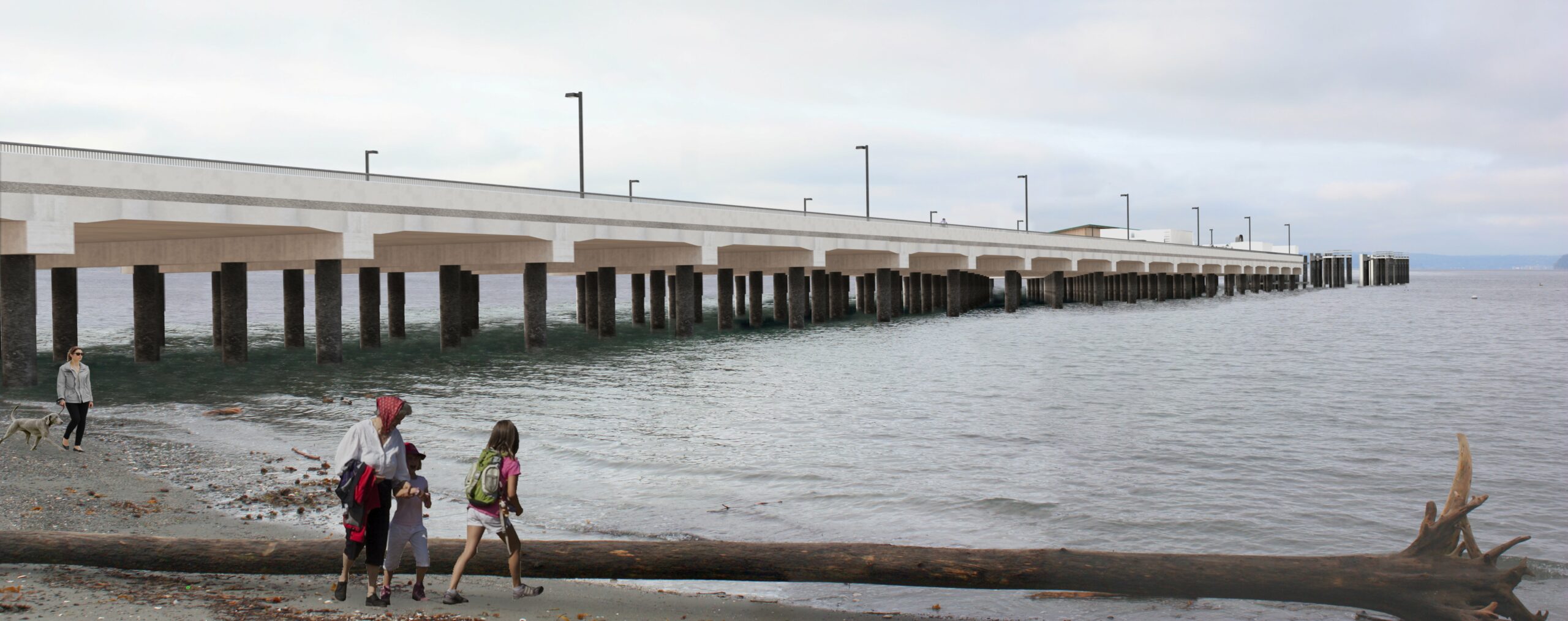
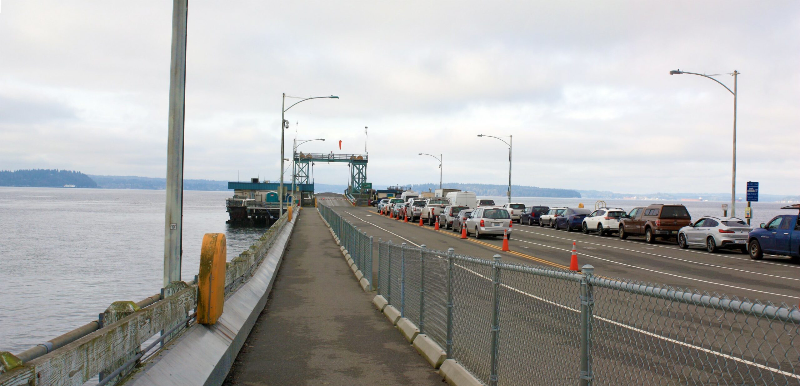
The first image of the current dock is taken from the King County Pump Station. The renderings help to show what each dock option would look like next to Cove Park.

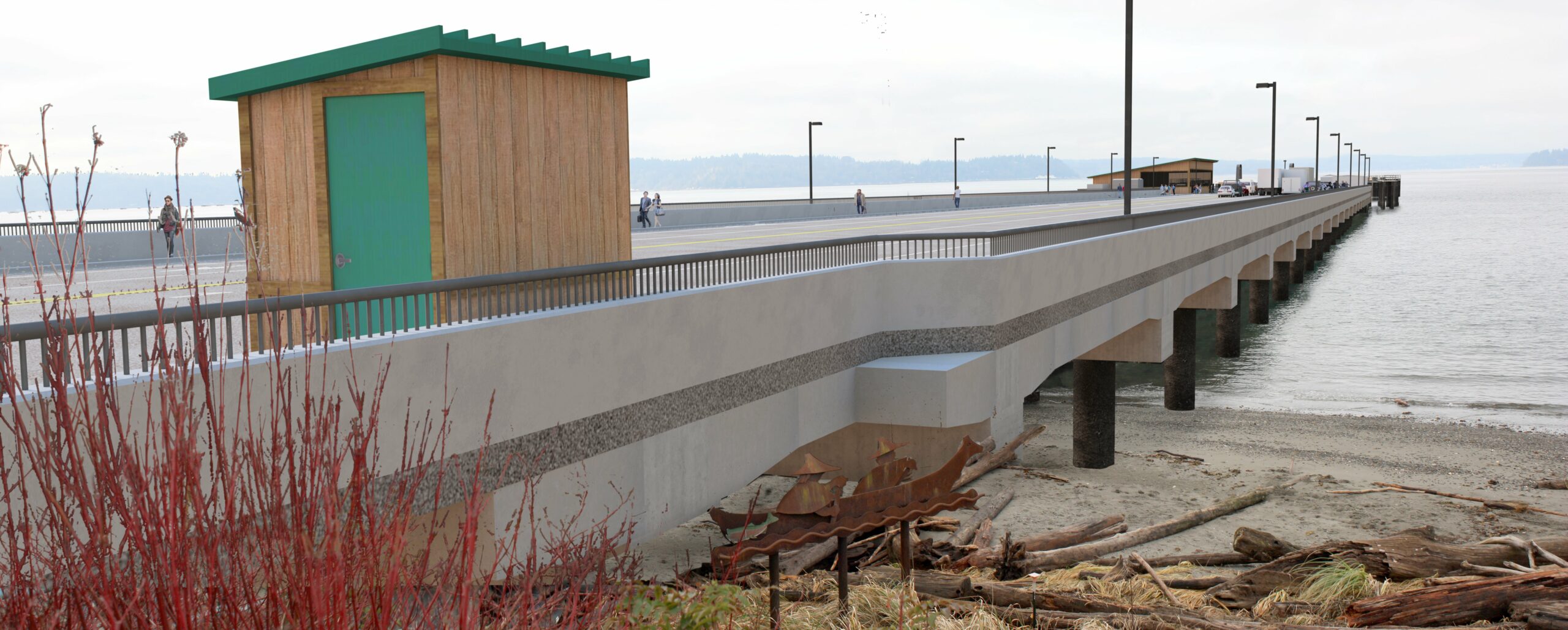
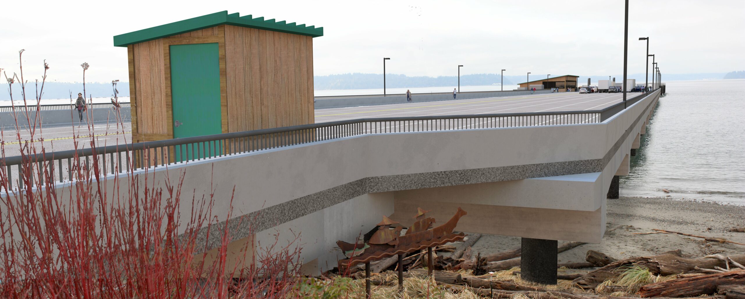
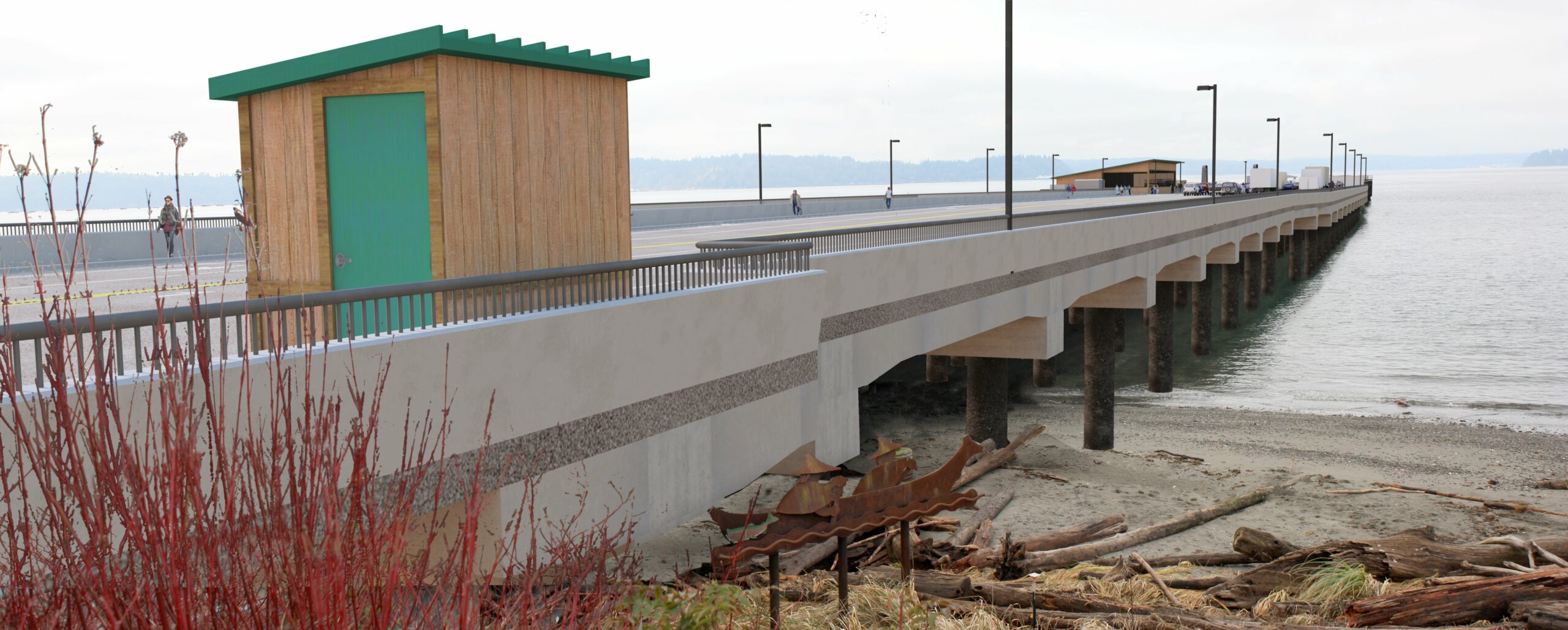
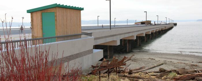
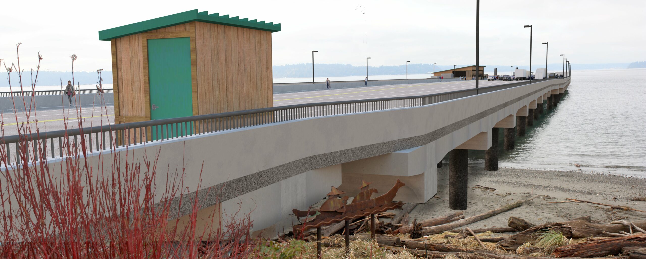
The next image shows a current view from Cove Park, and the renderings show how the various dock alternatives look from the beach.

The next view shows the existing walking path and bicycle lane, and the renderings show the walking path and bike lane for each alternative.


Finally, the last image shows the current view of the dock from Captain’s Park. The renderings show the view of each alternative from Captain’s Park.

Could WSF replace the dock with the same footprint we have today?
WSF considered and eliminated the same footprint alternative during the PEL study. This alternative was a dock that would be exactly the same size and footprint as the existing terminal. This option does not meet several elements of the project’s purpose and need:
- It does not provide efficient and safe loading and fare processing for pedestrians, vehicles and bicycles. The dock would be too crowded for crews to effectively sort and stage trucks, ADA, emergency and other priority vehicles.
- It does not provide operational efficiencies that support reliable service while meeting service levels projected for the route in the 2040 Long Range Plan, including less space to hold vehicles, longer backups along Fauntleroy Way and inability to sort traffic destined for two locations.
- It does not improve multimodal connections, enhance customer experience or accommodate ridership growth, consistent with the Long Range Plan. This option reduces service levels and does not meet projected ridership needs.
Screening criteria
The following table outlines the screening criteria WSF will use to evaluate the current alternatives and select a single alternative for further design and environmental review. Review the Level 3 Alternatives Summary for detailed information on the alternatives and screening criteria the team will use in Level 3 screening.
| Level 3 criteria | Performance factors for Level 3 screening |
|---|---|
| Ability to meet the requirements for structural reliability. | Factor: Does the alternative meet design codes and requirements for structural reliability? |
| Ability to accommodate projected sea level rise (resilience). | Factor: Does the alternative accommodate projected sea level rise? |
| Ability to improve operational efficiency (i.e., minimize dwell time, process vehicles more efficiently, maintain on-time performance). | Factor: How does the alternative maintain or improve ferry schedule reliability (timely and reliable loading and unloading)? |
| Factor: How does the alternative improve vehicle queuing on Fauntleroy Way? (Including potential upland and community effects, customer experience, etc.) | |
| Factor: Does the alternative improve WSF’s ability to stage and handle the mix of arriving volumes based on destination (Southworth or Vashon), truck traffic and transit? | |
| Factor: Does the alternative provide space to sort and accommodate Americans with Disabilities Act, emergency vehicles, medical requests and other preferential loading categories? | |
| Ability to reduce the number of conflict points between traffic modes (safety of vehicles, bicyclists and pedestrians). | Factor: Does the alternative reduce conflicts between people walking, biking, rolling and driving at the intersection of the terminal and Fauntleroy Way? |
| Factor: Does the alternative reduce or eliminate conflict(s) between people walking, biking, rolling and driving across the trestle during ferry loading and offloading? | |
| Factor: Does the alternative minimize conflicts between people driving on Fauntleroy Way and vehicles exiting the ferry terminal onto Fauntleroy Way? | |
| Ability to meet operational requirements (186 vehicles on the dock or in upland holding, access and maneuverability for an Issaquah Class vessel, connection to a minor arterial). | All alternatives provide a combined on-dock and upland holding (on Fauntleroy Way SW) of 186 vehicles. |
| All alternatives connect to Fauntleroy Way SW, which is classified as a minor arterial. | |
| Factor: Does the alternative provide sufficient access and maneuverability for Issaquah Class vessels? | |
| Ability to keep current sailing schedule (number of peak departures and crossing times). | See “Ability to improve operational efficiency” above. |
| Ability to enhance multimodal connections, connect to transit and/or allow for growth in walk-ons, people biking and vanpools. | Factor: What distance does the alternative provide for people to walk, bike and roll from Fauntleroy Way onto the ferry? |
| Factor: Does the alternative improve connections for people biking, walking or rolling? | |
| Factor: Does the alternative improve connections to transit (intersection improvements and/or crosswalks to provide safer, easier access to and from transit)? | |
| Ability to avoid changes to parks and recreational areas (Section 4(f)/6(f), Recreation and Conservation Office-funded projects). | Factor: What encroachment will the alternative have on Cove Park during construction? |
| Factor: What permanent encroachment will the alternative have on Cove Park? | |
| Factor: What encroachment will the alternative, including intersection changes, have on Captain’s Park during construction? | |
| Factor: What permanent encroachment will the alternative have on Captain’s Park? | |
| Requires changes to traffic circulation on local streets in ferry terminal area. | Factor: Does the alternative require changes to access or circulation patterns on local streets? |
| Project cost (design, planning, right of way, risk, construction) alignment with funding. | Factor: What is the alternative’s estimated program cost compared to available funding? |
| Factor: What is the alternative’s estimated cost of temporary facilities and operational needs during construction to maintain ferry service? | |
| Alignment with current project schedule. | Factor: What is the timeline to construct the alternative? |
| Project feasibility—amount of additional right of way needed beyond existing terminal footprint (for expanded footprint, utilities or construction). | Factor: What additional permanent right-of-way does this alternative require? |
| Permitting and coordination (level of coordination with external partners, permitting complexity, tribal coordination). | Factor: What potential cultural resource impacts does this alternative pose? |
| Factor: How does the alternative impact treaty fishing rights, based on early engagement with the tribes and their feedback on potential treaty fishing impacts? | |
| Factor: How much does the alternative increase overwater coverage? | |
| Factor: What is the alternative’s required environmental mitigation cost? | |
| Factor: How much does the alternative impact and/or provide opportunities to restore macroalgae and eelgrass? | |
| Policy risk. | Factor: Based on existing policies, does the alternative present risk for substantial project delay? |