English | Español
Welcome!
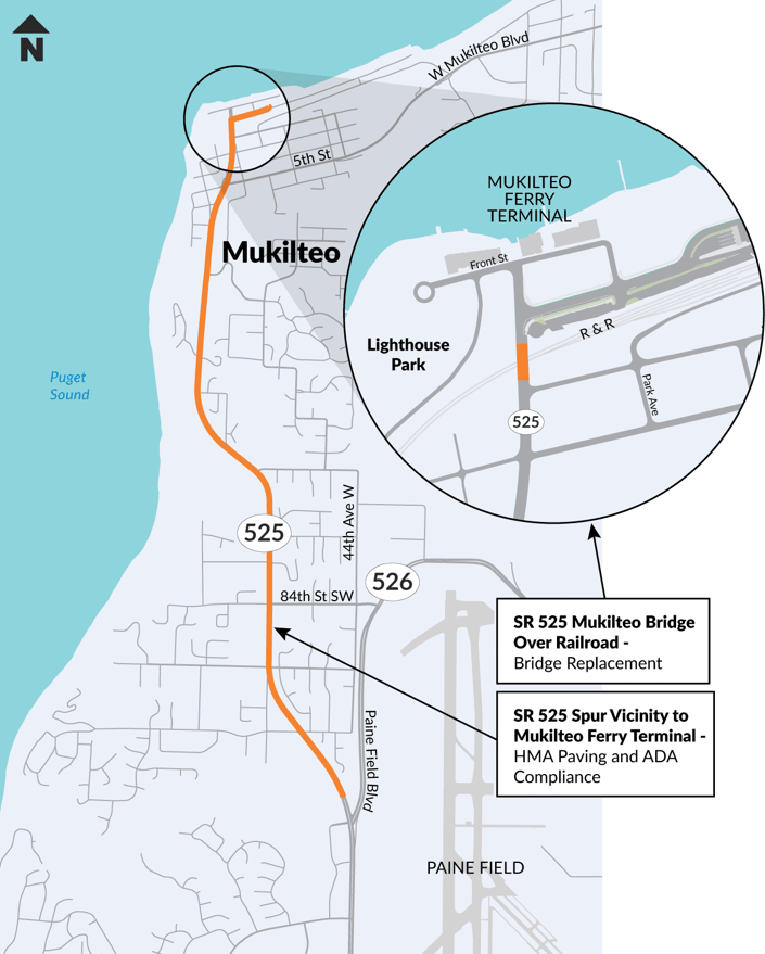
This online open house provides information about two important Washington State Department of Transportation (WSDOT) projects in the Mukilteo area:
- Project #1: SR 525 Spur Vicinity Mukilteo Ferry Terminal – HMA Paving and ADA Compliance
- Project #2: SR 525 Mukilteo Bridge Over Railroad – Bridge Replacement
You’ll find details about each project—including project needs, existing conditions, potential improvements, and opportunities to provide feedback. You’ll see several options we are considering for this corridor, and we want your vote at the end.
Your input will help shape design decisions, especially for bicycle and pedestrian facilities.
Complete Streets
Both projects reflect WSDOT’s commitment to Complete Streets, which ensure roadways are safe and accessible for all users—whether walking, biking, rolling, driving or using transit. The goal of Complete Streets is to improve the comfort and safety of active transportation users by:
- Decreasing pedestrian/bicyclist exposure
- Decreasing motor vehicle speed
- Helping drivers notice bicyclists and pedestrians more easily
- Increasing predictability of movement of all users through intersections
- Increasing separation in time and space between motorists, pedestrians and bicyclists
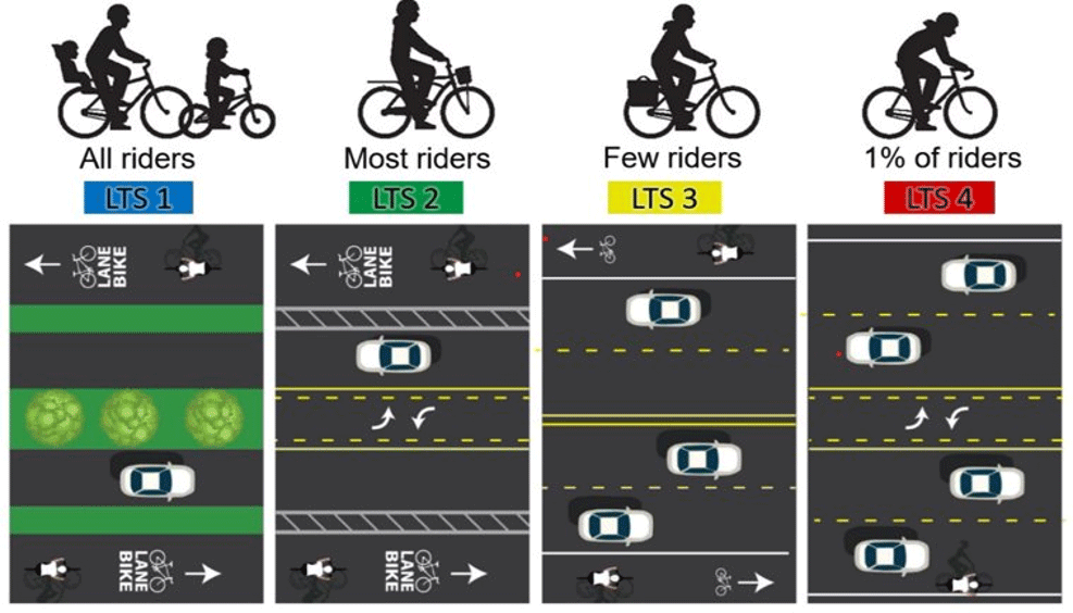
In designing facilities for walking and biking, we use Level of Traffic Stress (LTS) to determine how much space and separation to provide. LTS measures the stress that someone walking, rolling or biking feels on road segments and crossings.

Healthy Environment for All (HEAL) Act
We are also applying the principles of the Healthy Environment for All (HEAL) Act, which directs state agencies to address environmental health disparities that impact overburdened communities. Both projects are designated as significant agency actions which means an Environmental Justice Assessment will be completed and published. WSDOT staff will assess how this project may impact these communities and vulnerable populations and will engage with those directly affected to identify strategies to reduce harms and increase benefits associated with the project. WSDOT is using the Washington Environmental Health Disparities (EHD) Map and community input to help inform equitable design.
📅 This open house will be available through July 9th, 2025.