Transportation existing conditions
The study team collected data on existing conditions of the natural and built environment in the study area.
Summary of existing conditions:
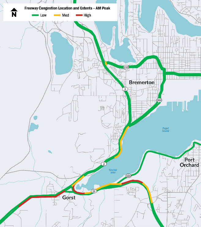
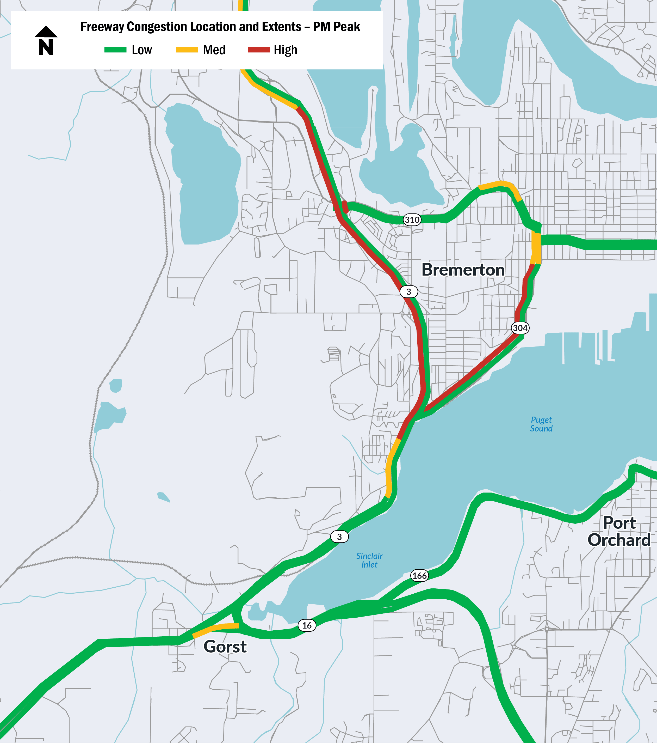
- SR 3 and SR 16 experience high travel demand and there is limited roadway space to accommodate future demand.
- SR 3 and SR 16 provide important transportation and mobility for Department of Defense operations.
- SR 3, SR 16, and SR 304 experience freight reliability and delay issues.
- A lack of shoulders and congestion on SR 3 impacts emergency response times.
- Infrastructure doesn’t meet current standards and hinders movement of freight and military vehicles.
- Fatal and serious injury crashes have occurred in the corridor.
- Limited transportation options for people without access to a personal vehicle, specifically active transportation and transit options.
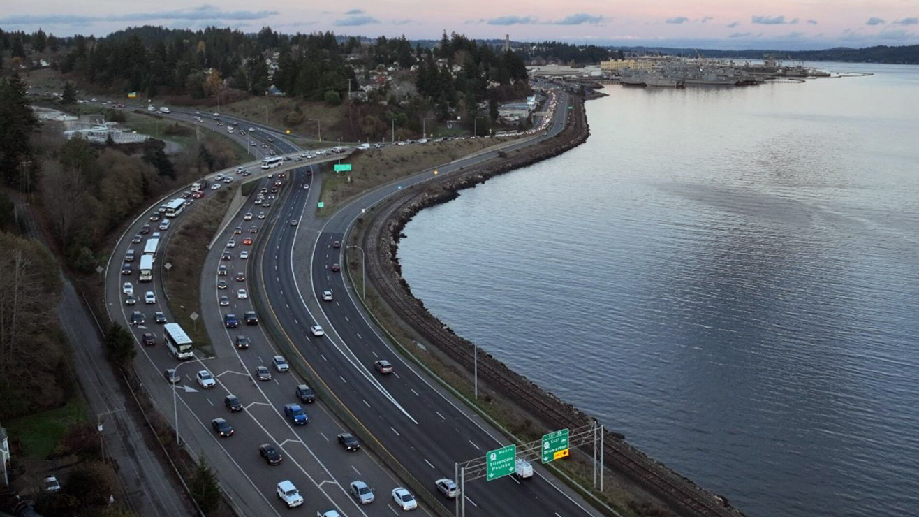
Traffic
- Northbound travel times between Port Orchard and the Naval Base Kitsap-Bremerton increase by up to 58 percent in the morning compared to when traffic is moving freely. Southbound travel times increase by up to 37 percent in the afternoon and evening compared to when traffic is moving freely.
- Naval Base Kitsap-Bremerton operations and Washington State Ferries arrivals and departures influence vehicle congestion.
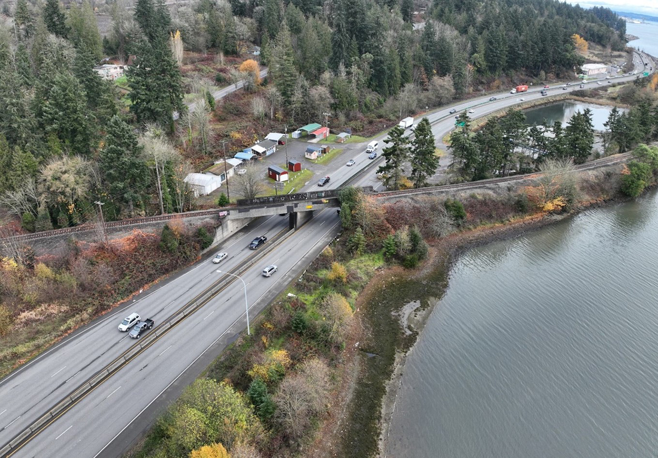
- Regional traffic mixes with local traffic in the Gorst area. This contributes to longer commute times between Silverdale, Bremerton, Port Orchard, Tacoma, and other areas in Kitsap County and beyond.
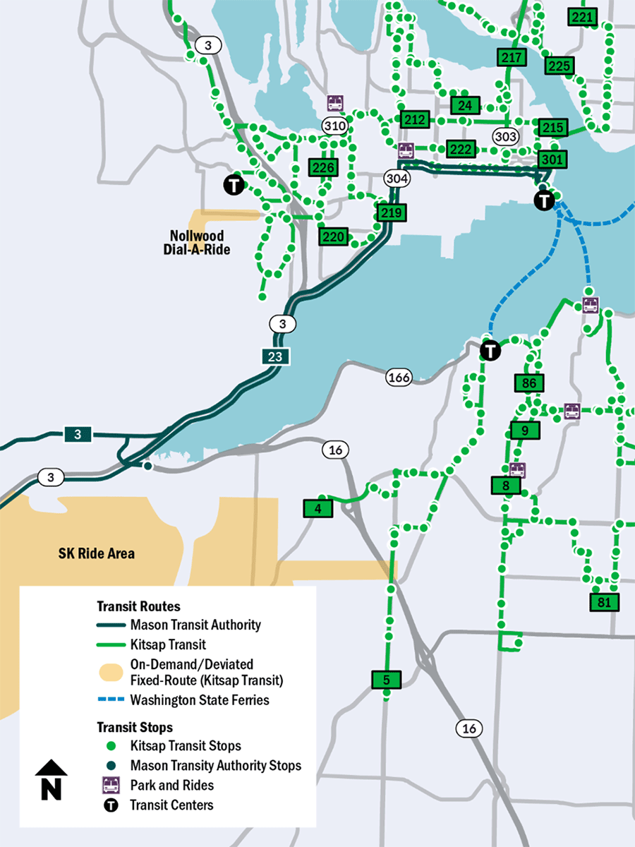
Transit
- Mason Transit and Kitsap Transit provide service in the study area. Mason Transit Route 3 and Route 23 operate along SR 3 in the study area.
- Naval Base employee buses operate between Naval Base Kitsap-Bremerton and Bangor.
- The Bremerton Ferry Terminal provides connections to Seattle, Annapolis, and Port Orchard via vehicle ferries and foot ferries.
Freight
- SR 3 is a key freight facility between Gorst and Bremerton, with trucks moving 10,470,000 tons of goods each year.
- Movement of oversized vehicles is limited by the Naval Railroad Bridge, which does not provide enough clearance.
- Today, oversized vehicles travel along local streets (Union Avenue W, 3rd Avenue W, Kent Avenue W, Sherman Heights Road, W Belfair Valley Road, W Sam Christopherson Avenue and Division Avenue W) to get around the Naval Railroad Bridge.
- The SR 3 corridor is included in the Strategic Highway Network, a network of highways important for the movement of military equipment and personnel.
Naval Railroad Bridge
- The bridge was built in 1945 and is nearing the end of its service life.
- The structure is vulnerable to earthquakes.
- The bridge imposes mobility restrictions with a vertical clearance below the current standard.
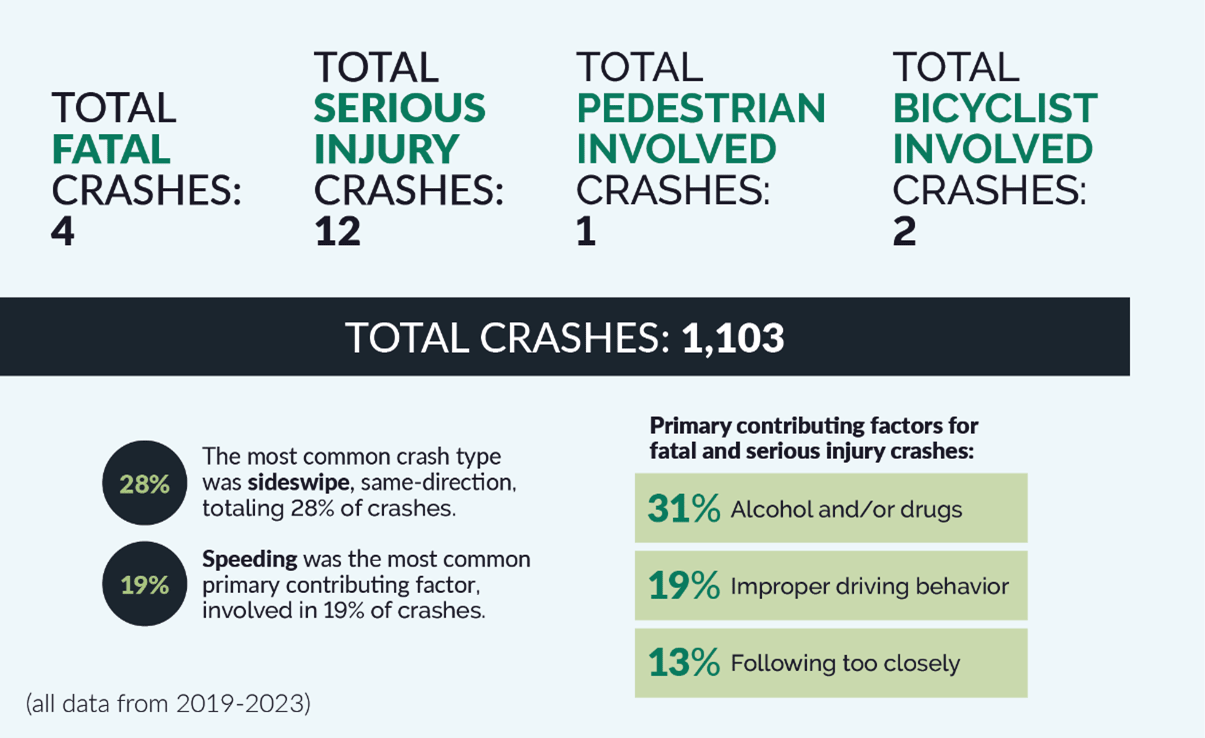
Safety
- The area needs safety improvements for both motorized and nonmotorized users of the corridor.
- From 2019 through 2023, there were 1,103 crashes in the study area. That includes four fatal crashes, 12 serious injury crashes, and three crashes involving people walking or biking in the area.
Active transportation
- There are no continuous active transportation facilities in the study area and very few safe crossing locations for people walking and biking
System resiliency existing conditions
- The Gorst area is susceptible to coastal hazards, such as tsunami inundation, flooding from multiple sources, future sea level rise, and heavy precipitation events due to climate change.
Environmental existing conditions
The team will study existing conditions for the following environmental categories.
- Air quality, greenhouse gas, and energy
- Cultural resources and archaeology
- Floodplains and sea level rise
- Geology and soils
- Hazardous materials
- Noise
- Section 4(f): parks, wildlife refuges and historic sites
- Section 6(f): public parks and recreation areas funded by the Land and Water Conservation Fund
- Socioeconomic and Environmental Justice
- Stormwater and water quality
- Fish, vegetation and wildlife
- Visual quality
- Wetlands and aquatic habitat
Fish passage
- The study team is currently evaluating fish barriers in the study area. This includes barriers at Gorst Creek and an unnamed tributary within Gorst near Peninsula Subaru. We are also looking at a drainage near the Bremerton Wastewater Treatment plant and SR 3/SR 304 interchange.
- Preliminary analysis found that the Wright Creek to Sinclair Inlet culvert replacement (WDFW ID 991995) is needed and replacement is part of this study.